
File:La Réunion department location map.svg

此SVG文件的PNG预览的大小:645 × 600像素。 其他分辨率:258 × 240像素 | 516 × 480像素 | 826 × 768像素 | 1,102 × 1,024像素 | 2,203 × 2,048像素 | 1,037 × 964像素。
原始文件 (SVG文件,尺寸为1,037 × 964像素,文件大小:113 KB)
摘要
| 相机位置 | | 在以下服务上查看本图像和附近其他图像: OpenStreetMap |
|---|
| 描述 |
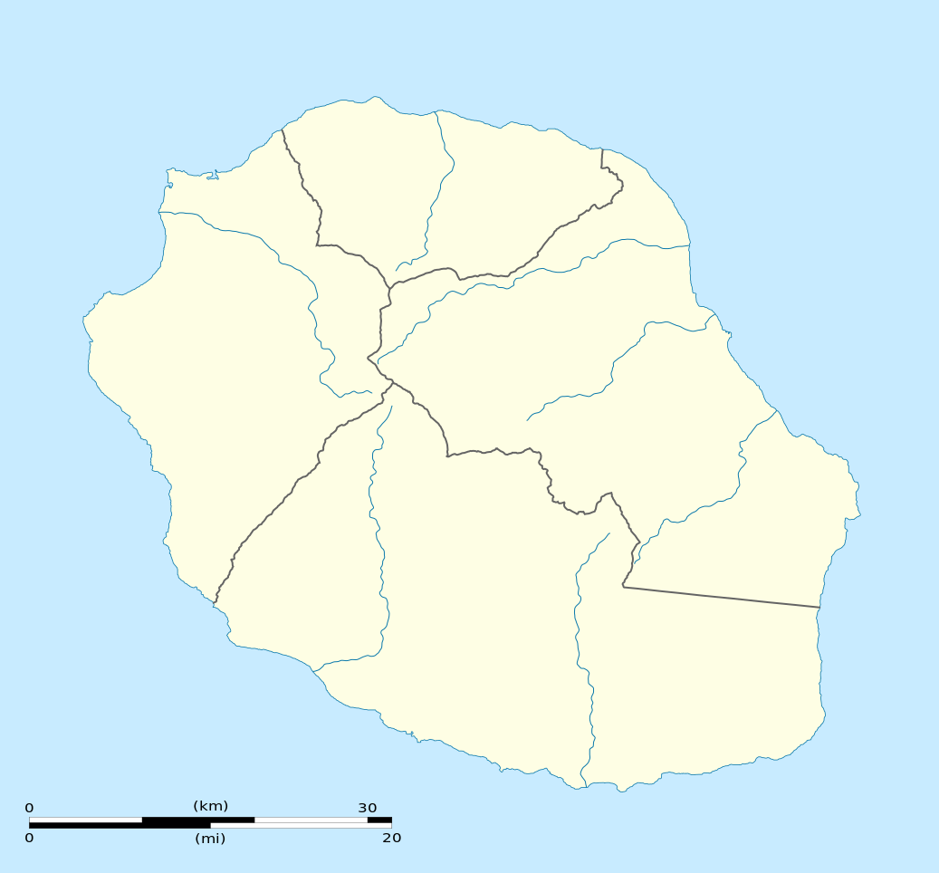
English: Blank physical map of the region and department of Réunion, France, for geo-location purpose.
Français : Carte physique vierge de la région et département de La Réunion, France, destinée à la géolocalisation. Scale: 1:300,000 (precision: 75 m)
Geographic limits of the map:
|
||
| 日期 | |||
| 来源 |
自己的作品
|
||
| 作者 | Eric Gaba (Sting - fr:Sting) | ||
| 授权 (二次使用本文件) |
|
||
| 其他版本 |
|

许可协议
我,本作品著作权人,特此采用以下许可协议发表本作品:
本文件采用知识共享署名-相同方式共享 3.0 未本地化版本许可协议授权。
- 您可以自由地:
- 共享 – 复制、发行并传播本作品
- 修改 – 改编作品
- 惟须遵守下列条件:
- 署名 – 您必须对作品进行署名,提供授权条款的链接,并说明是否对原始内容进行了更改。您可以用任何合理的方式来署名,但不得以任何方式表明许可人认可您或您的使用。
- 相同方式共享 – 如果您再混合、转换或者基于本作品进行创作,您必须以与原先许可协议相同或相兼容的许可协议分发您贡献的作品。

|
已授权您依据自由软件基金会发行的无固定段落及封面封底文字(Invariant Sections, Front-Cover Texts, and Back-Cover Texts)的GNU自由文件许可协议1.2版或任意后续版本的条款,复制、传播和/或修改本文件。该协议的副本请见“GNU Free Documentation License”。 |
您可以选择您需要的许可协议。
文件历史
点击某个日期/时间查看对应时刻的文件。
| 日期/时间 | 缩略图 | 大小 | 用户 | 备注 | |
|---|---|---|---|---|---|
| 当前 | 2009年3月23日 (一) 15:09 | | 1,037 × 964(113 KB) | Sting | == Summary == {{Location|21|07|30|S|55|31|30|E|scale:500000}} <br/> {{Information |Description={{en|Blank administrative map of the department of Réunion, France, for geo-location purpose.}} { |
文件用途
以下67个页面使用本文件:
- 2024年夏季奧林匹克運動會火炬傳遞
- 丰特奈修道院
- 亚眠主教座堂
- 兰斯主教座堂
- 凡尔赛宫
- 凡尔赛花园
- 加尔唐普河畔圣萨万教堂
- 加爾橋
- 勒·柯布西耶的建筑作品
- 勒唐蓬
- 勒阿弗尔
- 卡尔卡松城堡
- 卡里埃尔广场
- 卢瓦尔河谷 (传统地区)
- 古代剧场 (阿尔勒)
- 圣伯努瓦
- 圣但尼 (留尼汪)
- 圣保罗 (留尼汪)
- 圣勒弥爵隐修院
- 圣皮埃尔 (留尼汪)
- 圣米歇尔山湾
- 圣贝内泽桥
- 培雷火山
- 塔乌宫
- 塔普塔普阿泰
- 塞纳河
- 大岛 (斯特拉斯堡)
- 奥朗日凯旋门
- 奧朗日古羅馬劇場
- 巴黎
- 巴黎聖母院
- 布尔日主教座堂
- 教宗宮 (亞維農)
- 斯坦尼斯拉斯广场
- 斯康多拉保護區
- 斯特拉斯堡
- 斯特拉斯堡新城
- 新喀里多尼亞堡礁
- 方形神殿
- 普罗万
- 月亮港
- 枫丹白露宫
- 欧洲温泉疗养胜地
- 比利时和法国的钟楼
- 比利牛斯山脉-佩尔迪多山
- 沃邦防禦工事
- 沙特尔主教座堂
- 法国圣雅各伯朝圣之路
- 法國世界遺產列表
- 波尔托湾
- 科尔杜昂灯塔
- 米迪运河
- 聖米歇爾山
- 谢讷德皮
- 里昂
- 里昂老城
- 阿利扬斯广场
- 阿尔勒
- 阿尔卑斯地区史前湖岸木桩建筑
- 阿尔比主教城
- 阿爾克-瑟南的皇家鹽場
- 阿维尼翁主教座堂
- 韦兹莱隐修院
- 韦泽尔谷
- User:Liangent-bot/CleanupCiteYMD/巴黎
- Template:Location map Réunion
- Template:法国世界遗产
全域文件用途
以下其他wiki使用此文件:
- af.wikipedia.org上的用途
- als.wikipedia.org上的用途
- an.wikipedia.org上的用途
- ar.wikipedia.org上的用途
- az.wikipedia.org上的用途
- be-tarask.wikipedia.org上的用途
- be.wikipedia.org上的用途
- bg.wikipedia.org上的用途
- bs.wikipedia.org上的用途
- ceb.wikipedia.org上的用途
- Le Port
- Plantilya:Location map Réunion
- Table Point
- Bayonne (pagklaro)
- Petite Ile
- Possession
- Découverte
- Saint-André (pagklaro)
- Saint-Pierre (pagklaro)
- Eden
- Tapal
- Saint Paul Bay
- Maduran
- Plate
- L'Ilet
- Cap Noir
- Pointe Rouge
- Saint-Leu
- L'Eperon
- Bory
- Bras du Milieu
- Gros Morne
- Lac des Merles
- La Glacière
- La Petite Ile
- Le Grand Bras
- L'Éperon
- Le Petit Bras
- Les Bras
- Les Cascades
- L'Îlet
- Petite Île
查看本文件的更多全域用途。