
File:Map of unitary states.svg

此SVG文件的PNG预览的大小:800 × 411像素。 其他分辨率:320 × 164像素 | 640 × 329像素 | 1,024 × 526像素 | 1,280 × 657像素 | 2,560 × 1,314像素 | 863 × 443像素。
原始文件 (SVG文件,尺寸为863 × 443像素,文件大小:1.54 MB)
| 描述 |
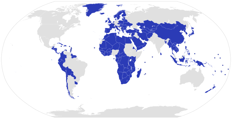
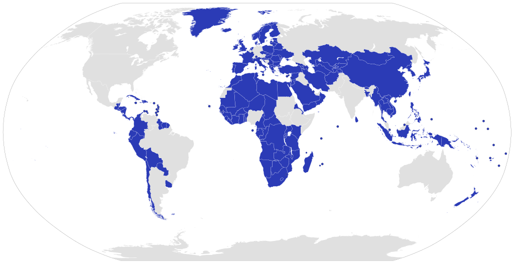
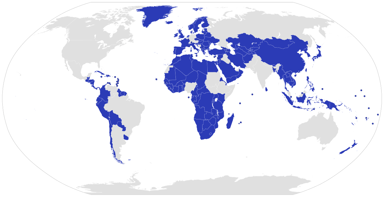
English: A map displaying today's Unitary states.
Comments:
Español: Mapa que muestra los Estados unitarios del mundo.
Comentario:
Português: Um mapa que mostra os Estados unitários do mundo.
Comentário:
Deutsch: Eine Weltkarte mit Hervorhebung aller Einheitsstaaten.
Anmerkung:
|
| 日期 | |
| 来源 | Own work based on BlankMap-World6.svg and the list in en:Unitary_state#List_of_unitary_states. Coloured similar to Unitarystates.png |
| 作者 | Lokal_Profil |
| 授权 (二次使用本文件) |
本文件采用知识共享署名-相同方式共享 2.5 通用许可协议授权。 署名: Lokal_Profil
|
| 其他版本 | Map of federal states.svg and Map of unitary and federal states.svg |
文件历史
点击某个日期/时间查看对应时刻的文件。
| 日期/时间 | 缩略图 | 大小 | 用户 | 备注 | |
|---|---|---|---|---|---|
| 当前 | 2022年9月10日 (六) 18:00 | | 863 × 443(1.54 MB) | Sharwa | Reverted to version as of 14:09, 13 July 2019 (UTC) |
| 2021年8月3日 (二) 11:56 |  | 863 × 443(1.57 MB) | Siirski | fix | |
| 2021年8月3日 (二) 11:52 |  | 863 × 443(1.57 MB) | Siirski | Added Somaliland | |
| 2019年7月13日 (六) 14:09 |  | 863 × 443(1.54 MB) | Іван Янковий | Reverted to version as of 20:55, 7 February 2014 (UTC) | |
| 2019年2月1日 (五) 11:48 |  | 512 × 263(782 KB) | AlexTref871 | Ukraine without Crimea | |
| 2014年2月7日 (五) 20:55 |  | 863 × 443(1.54 MB) | Thayts | Fixed Somalia by removing the added overlay, and removing its existing class from the unitary states style list | |
| 2013年2月13日 (三) 14:38 |  | 863 × 443(1.69 MB) | Middayexpress | colored Somalia grey; it's a federation | |
| 2012年3月25日 (日) 15:08 |  | 863 × 443(1.54 MB) | Smurfy | Updated to latest world map including South Sudan | |
| 2011年7月18日 (一) 15:19 |  | 940 × 477(1.56 MB) | Thayts | Added Curaçao and Sint Maarten, removed Netherlands Antilles following its dissolution | |
| 2007年9月26日 (三) 00:22 |  | 940 × 477(1.56 MB) | Lokal Profil | Less broken code and corrected metadata |
文件用途
没有页面链接到本图像。
全域文件用途
以下其他wiki使用此文件:
- als.wikipedia.org上的用途
- ar.wikipedia.org上的用途
- ast.wikipedia.org上的用途
- az.wikipedia.org上的用途
- ba.wikipedia.org上的用途
- be-tarask.wikipedia.org上的用途
- be.wikipedia.org上的用途
- ca.wikipedia.org上的用途
- ceb.wikipedia.org上的用途
- cs.wikipedia.org上的用途
- de.wikipedia.org上的用途
- el.wikipedia.org上的用途
- es.wikipedia.org上的用途
- fr.wikipedia.org上的用途
- gl.wikipedia.org上的用途
- gv.wikipedia.org上的用途
- hy.wikipedia.org上的用途
- id.wikipedia.org上的用途
- ja.wikipedia.org上的用途
- kk.wikipedia.org上的用途
- ko.wikipedia.org上的用途
- lt.wikipedia.org上的用途
- nl.wikipedia.org上的用途
- nl.wiktionary.org上的用途
- no.wikipedia.org上的用途
- oc.wikipedia.org上的用途
- pa.wikipedia.org上的用途
- ps.wikipedia.org上的用途
- rm.wikipedia.org上的用途
- ro.wikipedia.org上的用途
- ru.wikipedia.org上的用途
- sh.wikipedia.org上的用途
- si.wikipedia.org上的用途
- sk.wikipedia.org上的用途
- sr.wikipedia.org上的用途
- su.wikipedia.org上的用途
- sv.wikipedia.org上的用途
- th.wikipedia.org上的用途
- tr.wikipedia.org上的用途
查看本文件的更多全域用途。