
File:Tropical Cyclone Elita 2004.jpg

本预览的尺寸:473 × 599像素。 其他分辨率:189 × 240像素 | 379 × 480像素 | 606 × 768像素 | 808 × 1,024像素 | 1,617 × 2,048像素 | 6,000 × 7,600像素。
原始文件 (6,000 × 7,600像素,文件大小:6.41 MB,MIME类型:image/jpeg)
摘要
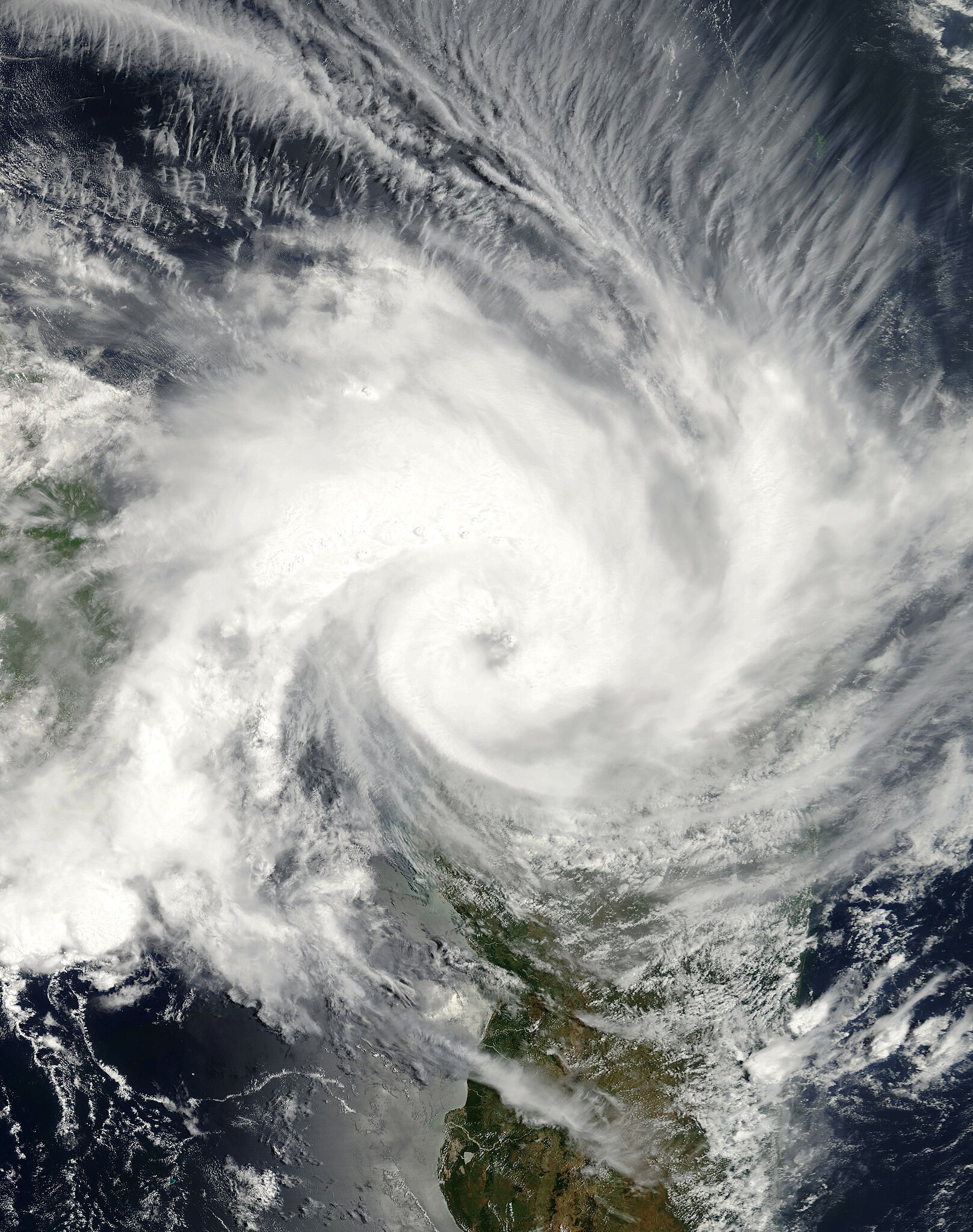
| 描述 | The Moderate Resolution Imaging Spectroradiometer (MODIS)instrument onboard NASA’s Terra satellite captured this true-color image of Tropical Cyclone Elita as it was making landfall off the coast of Mahajanga, Madagascar on January 28, 2004. Elita’s maximum sustained winds were near 60 knots (70 mph) with gusts to 75 knots (85 mph). The storm was expected to dissipate over the next 24-36 hours at it interacted with the Madagascar land body. | |||||
| 日期 | ||||||
| 来源 | http://visibleearth.nasa.gov/view_rec.php?id=6139 | |||||
| 作者 | Jeff Schmaltz, MODIS Rapid Response Team, NASA/GSFC | |||||
| 授权 (二次使用本文件) |
|
|||||
| 其他版本 | Image:TC Elita 28 jan 2004 0735Z.jpg |

文件历史
点击某个日期/时间查看对应时刻的文件。
| 日期/时间 | 缩略图 | 大小 | 用户 | 备注 | |
|---|---|---|---|---|---|
| 当前 | 2018年12月1日 (六) 22:51 | | 6,000 × 7,600(6.41 MB) | FleurDeOdile | show more of the storm |
| 2006年9月1日 (五) 21:49 |  | 6,800 × 6,800(5.09 MB) | Good kitty | == Summary == {{Information |Description=The Moderate Resolution Imaging Spectroradiometer (MODIS)instrument onboard NASA’s Terra satellite captured this true-color image of Tropical Cyclone Elita as it was making landfall off the coast of Mahajanga, Ma |
文件用途
以下12个页面使用本文件:
全域文件用途
以下其他wiki使用此文件:
- en.wikipedia.org上的用途
- Portal:Africa/Featured article
- Portal:Tropical cyclones/Did you know/Archive
- 2003–04 South-West Indian Ocean cyclone season
- Portal:Africa/Featured article/18
- Cyclone Elita
- Portal:Madagascar/Featured article/1
- Portal:Madagascar/Featured article
- Wikipedia:Today's featured article/March 2012
- User:Grondemar/Drafts/TFA/New
- Wikipedia:Today's featured article/March 7, 2012
- Wikipedia:Main Page history/2012 March 7
- User talk:Hurricanehink/Archive 23
- User:Jarda2020/2021–22 South-West Indian Ocean cyclone season
- pt.wikipedia.org上的用途