
File:Holy relic sites map of Andhra Pradesh.jpg
本预览的尺寸:640 × 599像素。 其他分辨率:256 × 240像素 | 820 × 768像素 | 1,093 × 1,024像素 | 1,563 × 1,464像素。
原始文件 (1,563 × 1,464像素,文件大小:1.19 MB,MIME类型:image/jpeg)
摘要
| 描述 |
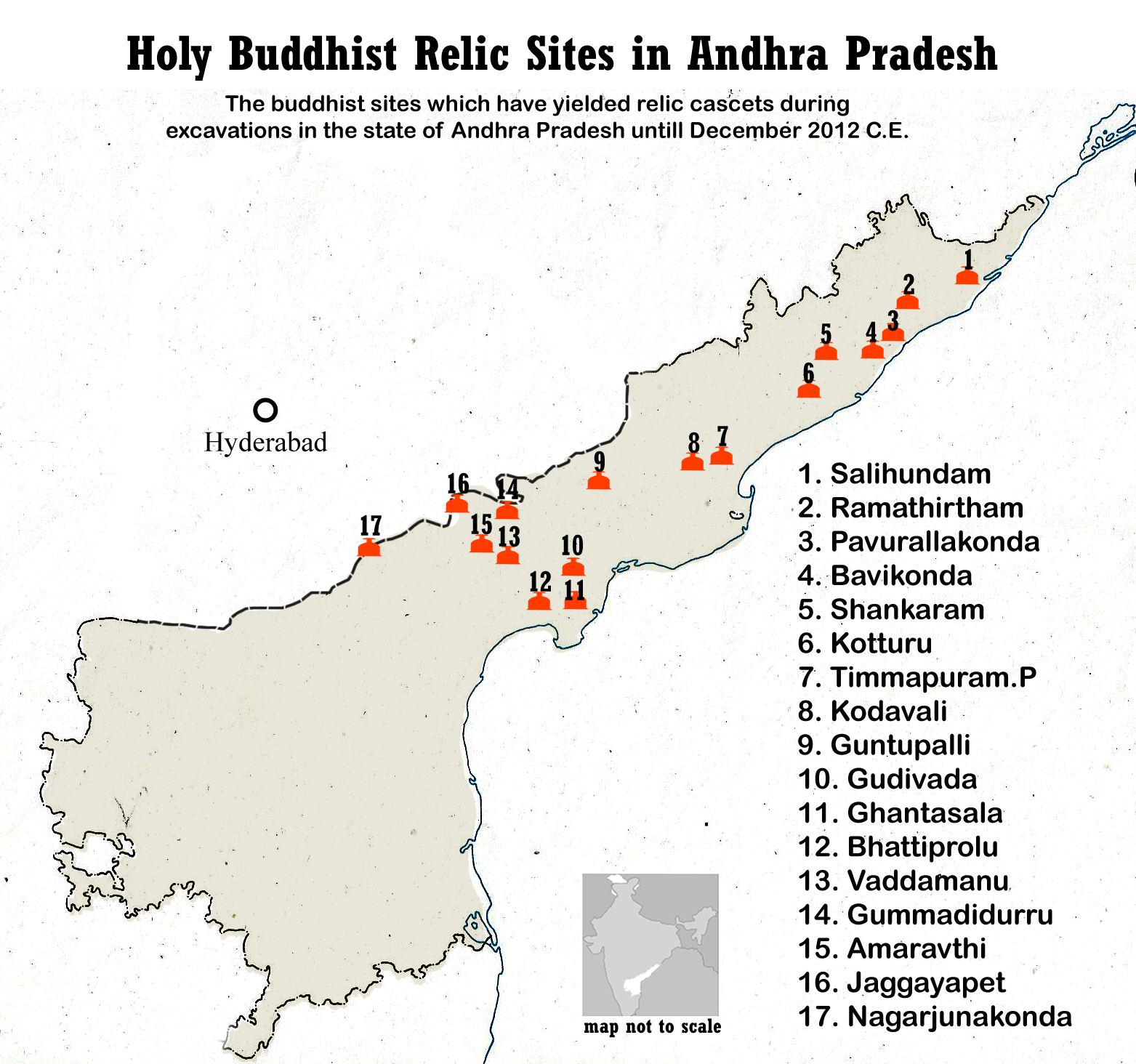
English: Buddhist sites map of Andhra Pradesh.
The excavated Buddhist sites which have yielded relic caskets during excavations in the state of Andhra Pradesh (numbered below and match those in the map above)
Other major Buddhist sites in Andhradesa from the 2nd-century BCE to 5th century CE. |
| 日期 | |
| 来源 | 自己的作品 |
| 作者 | Adityamadhav83 |
Illustration map not to scale. Details from AP State Museum, Hyderabad, India (with permission)
许可协议
我,本作品著作权人,特此采用以下许可协议发表本作品:
本文件采用知识共享署名-相同方式共享 3.0 未本地化版本许可协议授权。
- 您可以自由地:
- 共享 – 复制、发行并传播本作品
- 修改 – 改编作品
- 惟须遵守下列条件:
- 署名 – 您必须对作品进行署名,提供授权条款的链接,并说明是否对原始内容进行了更改。您可以用任何合理的方式来署名,但不得以任何方式表明许可人认可您或您的使用。
- 相同方式共享 – 如果您再混合、转换或者基于本作品进行创作,您必须以与原先许可协议相同或相兼容的许可协议分发您贡献的作品。
文件历史
点击某个日期/时间查看对应时刻的文件。
| 日期/时间 | 缩略图 | 大小 | 用户 | 备注 | |
|---|---|---|---|---|---|
| 当前 | 2014年5月8日 (四) 17:12 | | 1,563 × 1,464(1.19 MB) | Adityamadhav83 | The file has been modified due to the bifurcation of Andhra Pradesh. Locator map of India has been added |
| 2013年4月25日 (四) 15:23 |  | 1,563 × 1,464(1.17 MB) | Adityamadhav83 | User created page with UploadWizard |
文件用途
以下页面使用本文件:
全域文件用途
以下其他wiki使用此文件:
- azb.wikipedia.org上的用途
- bn.wikipedia.org上的用途
- en.wikipedia.org上的用途
- es.wikipedia.org上的用途
- hi.wikipedia.org上的用途
- it.wikipedia.org上的用途
- ka.wikipedia.org上的用途
- kn.wikipedia.org上的用途
- ml.wikipedia.org上的用途
- my.wikipedia.org上的用途
- or.wikipedia.org上的用途
- si.wikipedia.org上的用途
- ta.wikipedia.org上的用途
- te.wikipedia.org上的用途
查看本文件的更多全域用途。