
File:Landsat-emirau-island-adjusted.png
没有更高的分辨率。
Landsat-emirau-island-adjusted.png (568 × 348像素,文件大小:774 KB,MIME类型:image/png)
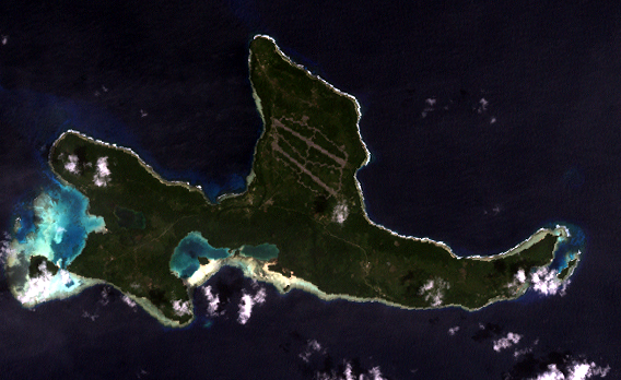
Orthocorrected Landsat 7 image of Emirau Island, New Ireland province, Papua New Guinea. Acquired 2000-II-6; orthocorrected by EarthSat. Source for this dataset was the Global Land Cover Facility archive copy at the Wayback Machine. Levels have been adjusted using GIMP. This is a public domain image.
|
|
文件历史
点击某个日期/时间查看对应时刻的文件。
| 日期/时间 | 缩略图 | 大小 | 用户 | 备注 | |
|---|---|---|---|---|---|
| 当前 | 2005年5月14日 (六) 18:00 | | 568 × 348(774 KB) | Dmoews~commonswiki | Orthocorrected Landsat 7 image of Emirau Island, New Ireland province, Papua New Guinea. Acquired 2000-II-6; orthocorrected by [http://www.earthsat.com/ EarthSat]. Source for this dataset was the [http://www.landcover.org/ Global Land Cover Facility]. |
文件用途
没有页面使用本文件。
全域文件用途
以下其他wiki使用此文件:
- fr.wikipedia.org上的用途
- gl.wikipedia.org上的用途
- it.wikipedia.org上的用途
- ja.wikipedia.org上的用途
- nl.wikipedia.org上的用途
- pnb.wikipedia.org上的用途
- www.wikidata.org上的用途