
File:As an extremely low-lying country, surrounded by vast oceans, Kiribati is at risk from the negative effects of climate change, such as sea-level rise and storm surges, 2011. Photo- Erin Magee - DFAT (12426392094).jpg
預覽大小:800 × 533 像素。 其他解析度:320 × 213 像素 | 640 × 427 像素 | 1,024 × 682 像素 | 1,280 × 853 像素 | 2,590 × 1,726 像素。
原始檔案 (2,590 × 1,726 像素,檔案大小:1.46 MB,MIME 類型:image/jpeg)
.jpg?uselang=zh-hant)
.jpg?uselang=zh-hant)
.jpg?action=history&uselang=zh-hant)
.jpg)
摘要
| 描述 |
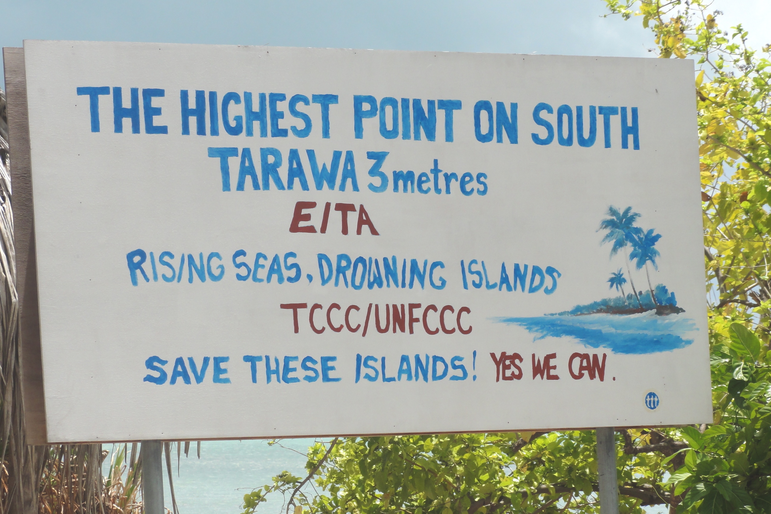
English: As an extremely low-lying country, surrounded by vast oceans, Kiribati is at risk from the negative effects of climate change, such as sea-level rise and storm surges, 2011. Photo: Erin Magee / DFAT. |
| 日期 | |
| 來源 | As an extremely low-lying country, surrounded by vast oceans, Kiribati is at risk from the negative effects of climate change, such as sea-level rise and storm surges, 2011. Photo: Erin Magee / DFAT |
| 作者 | Erin Magee/DFAT |
| 拍攝地點 | | 位於此地的本圖片與其他圖片: OpenStreetMap |
|---|
.jpg¶ms=001.363616_N_0173.085516_E_globe:Earth_type:camera_alt:120.6_source:exif_heading:205.25&language=zh-hant)
授權條款
此檔案採用創用CC 姓名標示 2.0 通用版授權條款。
姓名標示: Erin Magee/DFAT
- 您可以自由:
- 分享 – 複製、發佈和傳播本作品
- 重新修改 – 創作演繹作品
- 惟需遵照下列條件:
- 姓名標示 – 您必須指名出正確的製作者,和提供授權條款的連結,以及表示是否有對內容上做出變更。您可以用任何合理的方式來行動,但不得以任何方式表明授權條款是對您許可或是由您所使用。
| 這幅圖片原始出處為Flickr的https://www.flickr.com/photos/106853342@N04/12426392094 ,作者為DFAT photo library 。經機器人FlickreviewR在2014年4月14日審查後確定為採用cc-by-2.0的協議授權使用。 |
檔案歷史
點選日期/時間以檢視該時間的檔案版本。
| 日期/時間 | 縮圖 | 尺寸 | 使用者 | 備註 | |
|---|---|---|---|---|---|
| 目前 | 2014年4月14日 (一) 05:58 | | 2,590 × 1,726(1.46 MB) | Russavia | Transferred from Flickr via Flickr2commons |
檔案用途
下列頁面有用到此檔案:
全域檔案使用狀況
以下其他 wiki 使用了這個檔案:
- en.wikipedia.org 的使用狀況
- ig.wikipedia.org 的使用狀況
- sv.wikipedia.org 的使用狀況
.jpg)