
File:Ch-map cropped.jpg
無更高解析度可提供。
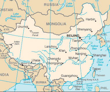
Ch-map_cropped.jpg (379 × 317 像素,檔案大小:100 KB,MIME 類型:image/jpeg)
Description: Map of China/Taiwan, cropped by me to focus on the two countries
Source: CIA World Factbook (https://www.cia.gov/library/publications/the-world-factbook/geos/ch.html archive copy at the Wayback Machine)
Date: Cropped and uploaded by me on April 30, 2005
Author: US Govt
Permission: Public Domain
Other versions of this file: See the web address above for the original, uncut version
|
|
 |
檔案歷史
點選日期/時間以檢視該時間的檔案版本。
| 日期/時間 | 縮圖 | 尺寸 | 使用者 | 備註 | |
|---|---|---|---|---|---|
| 目前 | 2008年5月27日 (二) 01:30 | | 379 × 317(100 KB) | KAVO | {{Information |Description= |Source= |Date= |Author= |Permission= |other_versions= }} |
| 2005年4月30日 (六) 14:44 |  | 379 × 317(105 KB) | DouglasGreen~commonswiki | Description: Map of China/Taiwan, cropped by me to focus on the two countries Source: CIA World Factbook (http://www.cia.gov/cia/publications/factbook/geos/ch.html) Date: Cropped and uploaded by me on April 30, 2005 Author: US Govt Permission: Public |
檔案用途
下列頁面有用到此檔案:
全域檔案使用狀況
以下其他 wiki 使用了這個檔案:
- be-tarask.wikipedia.org 的使用狀況
- bn.wikibooks.org 的使用狀況
- ca.wikipedia.org 的使用狀況
- cy.wikipedia.org 的使用狀況
- dsb.wikipedia.org 的使用狀況
- en.wikipedia.org 的使用狀況
- en.wikibooks.org 的使用狀況
- en.wikinews.org 的使用狀況
- en.wiktionary.org 的使用狀況
- eu.wikipedia.org 的使用狀況
- fr.wikinews.org 的使用狀況
- gag.wikipedia.org 的使用狀況
- gl.wikipedia.org 的使用狀況
- ia.wikipedia.org 的使用狀況
- incubator.wikimedia.org 的使用狀況
- mr.wikipedia.org 的使用狀況
- pl.wiktionary.org 的使用狀況
- pt.wikibooks.org 的使用狀況
- ru.wikipedia.org 的使用狀況
- simple.wiktionary.org 的使用狀況
- sk.wikipedia.org 的使用狀況
- sv.wikipedia.org 的使用狀況
- vls.wikipedia.org 的使用狀況
- www.wikidata.org 的使用狀況