
File:Giri 2010-10-22 0655Z.jpg

預覽大小:461 × 599 像素。 其他解析度:184 × 240 像素 | 369 × 480 像素 | 591 × 768 像素 | 788 × 1,024 像素 | 1,575 × 2,048 像素 | 4,000 × 5,200 像素。
原始檔案 (4,000 × 5,200 像素,檔案大小:3.92 MB,MIME 類型:image/jpeg)
摘要
| 描述 |
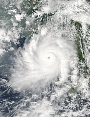
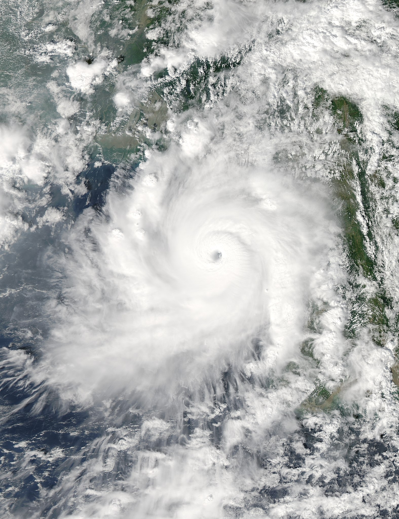
English: This image, taken by the Moderate Resolution Imaging Spectroradiometer (MODIS) on NASA’s Aqua satellite, shows Very Severe Cyclonic Storm Giri moving ashore over Myanmar (Burma) at 1:25 p.m. local time (06:55 UTC) on October 22, 2010. It shows a compact, mature storm with a well-defined eye and a circular shape. |
| 日期 | |
| 來源 | http://earthobservatory.nasa.gov/NaturalHazards/view.php?id=46489 |
| 作者 | NASA image courtesy Jeff Schmaltz, MODIS Rapid Response Team at NASA GSFC |
| 其他版本 |
|

| 拍攝地點 | | 位於此地的本圖片與其他圖片: OpenStreetMap |
|---|
授權條款
| 本作品由NASA創作,屬於公有領域。根據NASA的版權政策:“NASA的創作除非另有聲明否則不受版權保護。”(參見:Template:PD-USGov/zh,NASA版權政策或JPL圖像使用政策) | ||
 |
警告:
|
檔案歷史
點選日期/時間以檢視該時間的檔案版本。
| 日期/時間 | 縮圖 | 尺寸 | 使用者 | 備註 | |
|---|---|---|---|---|---|
| 目前 | 2013年3月24日 (日) 07:10 | | 4,000 × 5,200(3.92 MB) | Meow | Reverted to version as of 09:24, 13 March 2013 Earth100: This is the WITHOUT BORDERS edition. |
| 2013年3月21日 (四) 14:42 |  | 4,000 × 5,200(2.88 MB) | Earth100 | Original image in original, higher quality. Also includes lines which marks shorelines which allows viewers to see where and how close the storm was from land. | |
| 2013年3月13日 (三) 09:24 |  | 4,000 × 5,200(3.92 MB) | Meow | User created page with UploadWizard |
檔案用途
下列2個頁面有用到此檔案:
全域檔案使用狀況
以下其他 wiki 使用了這個檔案:
- en.wikipedia.org 的使用狀況
- ko.wikipedia.org 的使用狀況
- my.wikipedia.org 的使用狀況