
File:Hawaii Island topographic map-en.svg

此 SVG 檔案的 PNG 預覽的大小:728 × 600 像素。 其他解析度:291 × 240 像素 | 583 × 480 像素 | 932 × 768 像素 | 1,243 × 1,024 像素 | 2,485 × 2,048 像素 | 3,110 × 2,563 像素。
原始檔案 (SVG 檔案,表面大小:3,110 × 2,563 像素,檔案大小:2.12 MB)
摘要
| 描述 |
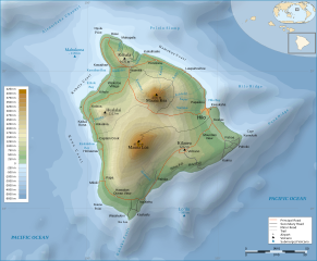
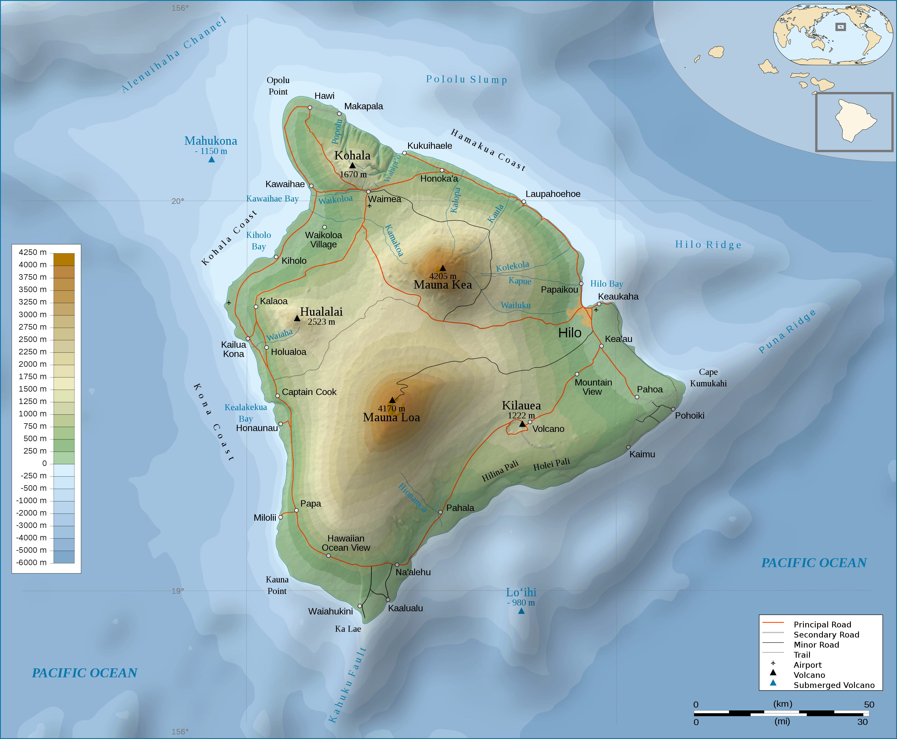
English: Topographic Map in english of the island of Hawaii. |
| 日期 | (UTC) |
| 來源 | |
| 作者 |
|
| 其他版本 |
[]
|


授權條款
此檔案採用創用CC 姓名標示-相同方式分享 3.0 未在地化版本授權條款。
- 您可以自由:
- 分享 – 複製、發佈和傳播本作品
- 重新修改 – 創作演繹作品
- 惟需遵照下列條件:
- 姓名標示 – 您必須指名出正確的製作者,和提供授權條款的連結,以及表示是否有對內容上做出變更。您可以用任何合理的方式來行動,但不得以任何方式表明授權條款是對您許可或是由您所使用。
- 相同方式分享 – 如果您利用本素材進行再混合、轉換或創作,您必須基於如同原先的相同或兼容的條款,來分布您的貢獻成品。
原始上傳日誌
This image is a derivative work of the following images:
- File:Hawaii_Island_topographic_map-fr.svg licensed with Cc-by-sa-3.0,2.5,2.0,1.0, GFDL
- 2009-02-16T12:24:40Z Sémhur 3110x2563 (2213946 Bytes) Valid SVG
- 2008-05-07T17:31:00Z Sémhur 3110x2563 (2292418 Bytes) Route coupée trop courte, je rallonge.
- 2008-05-02T17:57:22Z Sémhur 3110x2563 (2290853 Bytes) Suppression d'une partie d'une route détruite par une coulée de lave
- 2008-05-01T10:37:28Z Sémhur 3110x2563 (2290359 Bytes) New version, with vectorized shaded relief
- 2008-04-29T18:35:04Z Sting 3110x2563 (1041004 Bytes) Slight correction
- 2008-04-29T18:11:00Z Sting 3110x2563 (1041493 Bytes) Added legend
- 2008-04-22T16:01:56Z Sémhur 3110x2563 (1036030 Bytes) Espacement de lettres (oubli)
- 2008-04-19T08:45:11Z Sémhur 3110x2563 (1034767 Bytes) Correction de l'altitude du Mauna Loa et espacement de lettres
- 2008-04-17T19:04:48Z Sémhur 3110x2563 (1019305 Bytes) Correction d'un problème avec le relief
- 2008-04-17T18:47:58Z Sémhur 3110x2563 (1019765 Bytes) == Description == {{Information |Description= {{en| Topographic Map in french of the island of [[:en:Hawaii (Island)|Hawaii]].}} {{fr| Carte topographique de l'île de [[:fr:Hawaii|Hawaii]].}} |Source=Travail personnel. {{clr
Uploaded with derivativeFX
檔案歷史
點選日期/時間以檢視該時間的檔案版本。
| 日期/時間 | 縮圖 | 尺寸 | 使用者 | 備註 | |
|---|---|---|---|---|---|
| 目前 | 2009年3月3日 (二) 22:56 | | 3,110 × 2,563(2.12 MB) | Kmusser | attempted legend fix |
| 2009年3月3日 (二) 22:54 |  | 3,110 × 2,563(2.12 MB) | Kmusser | attempted legend fix | |
| 2009年3月3日 (二) 22:49 |  | 3,110 × 2,563(2.12 MB) | Kmusser | legend fix | |
| 2009年3月3日 (二) 22:06 |  | 3,110 × 2,563(2.12 MB) | Kmusser | {{Information |Description={{Topographic Map in english of the island of Hawaii.}} |Source=*File:Hawaii_Island_topographic_map-fr.svg |Date=2009-03-03 22:04 (UTC) |Author=*File:Hawaii_Island_topographic_map-fr.svg: [[Us |
檔案用途
下列頁面有用到此檔案:
全域檔案使用狀況
以下其他 wiki 使用了這個檔案:
- af.wikipedia.org 的使用狀況
- cy.wikipedia.org 的使用狀況
- de.wikipedia.org 的使用狀況
- el.wikipedia.org 的使用狀況
- en.wikipedia.org 的使用狀況
- eo.wikipedia.org 的使用狀況
- fa.wikipedia.org 的使用狀況
- fr.wikipedia.org 的使用狀況
- fy.wikipedia.org 的使用狀況
- hr.wikipedia.org 的使用狀況
- ja.wikipedia.org 的使用狀況
- ka.wikipedia.org 的使用狀況
- nl.wikipedia.org 的使用狀況
- pl.wikipedia.org 的使用狀況
- tr.wikipedia.org 的使用狀況