
File:Iowa topography.jpg

預覽大小:800 × 540 像素。 其他解析度:320 × 216 像素 | 640 × 432 像素 | 1,024 × 691 像素 | 1,280 × 864 像素 | 2,560 × 1,729 像素 | 3,560 × 2,404 像素。
原始檔案 (3,560 × 2,404 像素,檔案大小:4 MB,MIME 類型:image/jpeg)
| 描述 |
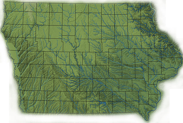
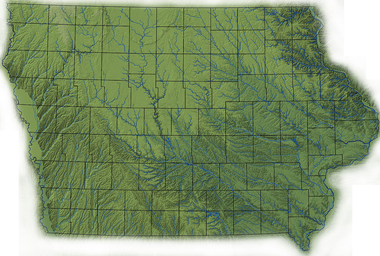
English: topographic map of Iowa created in ArcMap using ISUGIS 30-M USGS DEM, fade in Photoshop |
| 日期 | |
| 來源 | 自己的作品 (Original text: I created this work entirely by myself.) |
| 作者 | Billwhittaker (talk) |
授權條款
英文維基百科的Billwhittaker,此作品的版權所有人,決定用以下授權條款發佈本作品:
此檔案採用創用CC 姓名標示-相同方式分享 3.0 未在地化版本授權條款。
姓名標示: 英文維基百科的Billwhittaker
- 您可以自由:
- 分享 – 複製、發佈和傳播本作品
- 重新修改 – 創作演繹作品
- 惟需遵照下列條件:
- 姓名標示 – 您必須指名出正確的製作者,和提供授權條款的連結,以及表示是否有對內容上做出變更。您可以用任何合理的方式來行動,但不得以任何方式表明授權條款是對您許可或是由您所使用。
- 相同方式分享 – 如果您利用本素材進行再混合、轉換或創作,您必須基於如同原先的相同或兼容的條款,來分布您的貢獻成品。

|
已授權您依據自由軟體基金會發行的無固定段落、封面文字和封底文字GNU自由文件授權條款1.2版或任意後續版本,對本檔進行複製、傳播和/或修改。該協議的副本列在GNU自由文件授權條款中。 |
您可以選擇您需要的授權條款。
原始上傳日誌
Transferred from en.wikipedia to Commons by Sfan00_IMG using CommonsHelper.
The original description page was here. All following user names refer to en.wikipedia.
- 2008-09-02 15:49 Billwhittaker 3560×2404× (4198982 bytes) {{Information |Description= |Source=I created this work entirely by myself. |Date= |Author=~~~ |other_versions= }}
- 2008-09-02 15:47 Billwhittaker 3560×2404× (4233020 bytes) {{Information |Description=topographic map of Iowa created in ArcMap using ISUGIS 30-M USGS DEM, fade in Photoshop |Source=I created this work entirely by myself. |Date=2008 |Author=~~~ |other_versions= }}
i lived here
檔案歷史
點選日期/時間以檢視該時間的檔案版本。
| 日期/時間 | 縮圖 | 尺寸 | 使用者 | 備註 | |
|---|---|---|---|---|---|
| 目前 | 2009年4月14日 (二) 15:45 | | 3,560 × 2,404(4 MB) | File Upload Bot (Magnus Manske) | {{BotMoveToCommons|en.wikipedia|year={{subst:CURRENTYEAR}}|month={{subst:CURRENTMONTHNAME}}|day={{subst:CURRENTDAY}}}} {{Information |Description={{en|topographic map of Iowa created in ArcMap using ISUGIS 30-M USGS DEM, fade in Photoshop<br/> == Licensi |
檔案用途
下列2個頁面有用到此檔案:
全域檔案使用狀況
以下其他 wiki 使用了這個檔案:
- ca.wikipedia.org 的使用狀況
- el.wikipedia.org 的使用狀況
- en.wikipedia.org 的使用狀況
- es.wikipedia.org 的使用狀況
- fy.wikipedia.org 的使用狀況
- gu.wikipedia.org 的使用狀況
- hsb.wikipedia.org 的使用狀況
- ja.wikipedia.org 的使用狀況
- kn.wikipedia.org 的使用狀況
- pt.wikipedia.org 的使用狀況
- simple.wikipedia.org 的使用狀況