
File:King Island Houses USGS ric00642.jpg
預覽大小:800 × 483 像素。 其他解析度:320 × 193 像素 | 640 × 386 像素 | 1,024 × 618 像素 | 1,280 × 773 像素 | 2,560 × 1,545 像素 | 3,936 × 2,376 像素。
原始檔案 (3,936 × 2,376 像素,檔案大小:6.02 MB,MIME 類型:image/jpeg)
摘要
| 描述 |
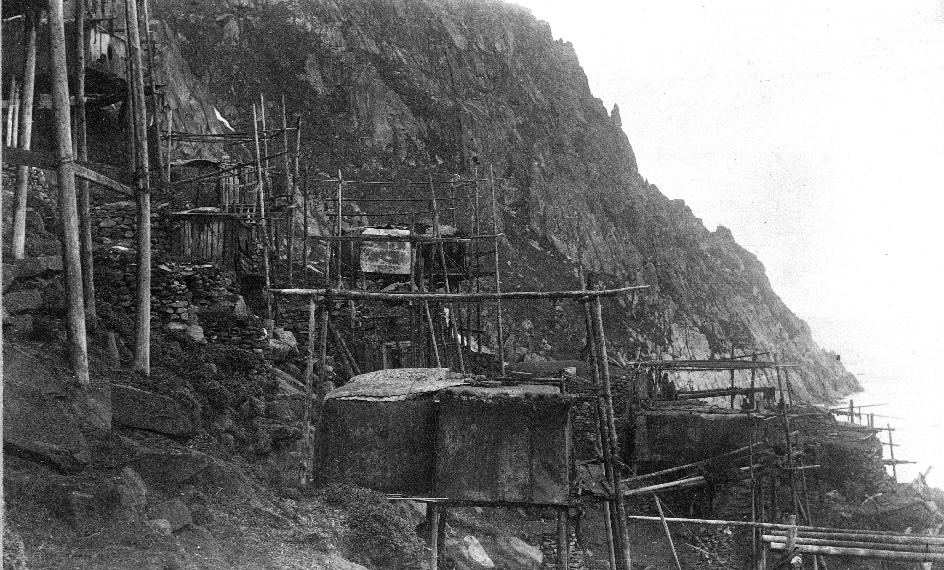
English: View of Kings Island Houses. Nome district, Seward Penensula region. Alaska. cc 1892. Stilt houses on a rocky bank, built of driftwood poles, planks, and hide or fabric covers. Some stone structures also visible. Several residents visible. |
| 日期 | cc 1892 per USGS |
| 來源 | U.S. Geological Survey Photographic Library [1] High resolution version. |
| 作者 | Israel C. Russell |
| 拍攝地點 | | 位於此地的本圖片與其他圖片: OpenStreetMap |
|---|
授權條款
|
|
檔案歷史
點選日期/時間以檢視該時間的檔案版本。
| 日期/時間 | 縮圖 | 尺寸 | 使用者 | 備註 | |
|---|---|---|---|---|---|
| 目前 | 2010年5月18日 (二) 14:02 | | 3,936 × 2,376(6.02 MB) | Dankarl | {{Information |Description={{en|1=View of Kings Island Houses. Nome district, Seward Penensula region. Alaska. cc 1892. Stilt houses on a rocky bank.}} |Source=U.S. Geological Survey Photographic Library [http://libraryphoto.cr.usgs.gov/cgi-bin/show_pict |
檔案用途
下列頁面有用到此檔案:
全域檔案使用狀況
以下其他 wiki 使用了這個檔案:
- az.wikipedia.org 的使用狀況
- en.wikipedia.org 的使用狀況
- ik.wikipedia.org 的使用狀況
- tr.wikipedia.org 的使用狀況