
File:Ocean gravity map.gif
預覽大小:800 × 473 像素。 其他解析度:320 × 189 像素 | 640 × 378 像素 | 1,010 × 597 像素。
原始檔案 (1,010 × 597 像素,檔案大小:466 KB,MIME 類型:image/gif)
| 描述 |
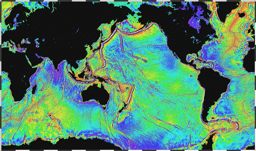
English: Ocean basins mapped with satellite altimetry. Seafloor features larger than 10 km are detected by resulting gravitational distortion of sea surface. |
| 日期 | |
| 來源 | http://www.ngdc.noaa.gov/mgg/bathymetry/predicted/explore.HTML |
| 作者 | NOAA |
本圖像屬於公有領域,因該作品最初來自於美國國家海洋和大氣管理局職員的職務作品。
|
檔案歷史
點選日期/時間以檢視該時間的檔案版本。
| 日期/時間 | 縮圖 | 尺寸 | 使用者 | 備註 | |
|---|---|---|---|---|---|
| 目前 | 2006年4月3日 (一) 22:18 | | 1,010 × 597(466 KB) | Korrigan | Ocean basins mapped with satellite altimetry. Seafloor features larger than 10 km are detected by resulting gravitational distortion of sea surface. Source: http://www.ngdc.noaa.gov/mgg/bathymetry/predicted/explore.HTML {{PD-USGov-DOC-NOAA}} [[Cate |
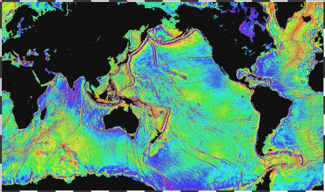
| 2006年3月19日 (日) 20:36 |  | 1,010 × 597(196 KB) | Maksim | La bildo estas kopiita de wikipedia:en. La originala priskribo estas: Ocean basins mapped with satellite altimetry. Seafloor features larger than 10 km are detected by resulting gravitational distortion of sea surface. Source: http://www.ngdc.noaa.go |
檔案用途
全域檔案使用狀況
以下其他 wiki 使用了這個檔案:
- bs.wikipedia.org 的使用狀況
- bxr.wikipedia.org 的使用狀況
- cs.wikipedia.org 的使用狀況
- de.wikipedia.org 的使用狀況
- el.wikipedia.org 的使用狀況
- en.wikipedia.org 的使用狀況
- eo.wikipedia.org 的使用狀況
- es.wikipedia.org 的使用狀況
- et.wikipedia.org 的使用狀況
- fi.wikipedia.org 的使用狀況
- fo.wikipedia.org 的使用狀況
- fr.wikipedia.org 的使用狀況
- fr.wiktionary.org 的使用狀況
- gd.wikipedia.org 的使用狀況
- gl.wikipedia.org 的使用狀況
- gu.wikipedia.org 的使用狀況
- he.wikipedia.org 的使用狀況
- hi.wikipedia.org 的使用狀況
- hr.wikipedia.org 的使用狀況
- ht.wikipedia.org 的使用狀況
- hy.wikipedia.org 的使用狀況
- hyw.wikipedia.org 的使用狀況
- ja.wikipedia.org 的使用狀況
- kk.wikipedia.org 的使用狀況
- la.wikipedia.org 的使用狀況
- lv.wikipedia.org 的使用狀況
- mn.wikipedia.org 的使用狀況
- ru.wikipedia.org 的使用狀況
- scn.wikipedia.org 的使用狀況
- sh.wikipedia.org 的使用狀況
- sl.wikipedia.org 的使用狀況
- sv.wikipedia.org 的使用狀況
- ta.wikipedia.org 的使用狀況
檢視此檔案的更多全域使用狀況。