
File:Champ1632 82.jpg
預覽大小:800 × 438 像素。 其他解析度:320 × 175 像素 | 640 × 350 像素 | 1,024 × 560 像素 | 1,845 × 1,009 像素。
原始檔案 (1,845 × 1,009 像素,檔案大小:936 KB,MIME 類型:image/jpeg)
| 描述 |
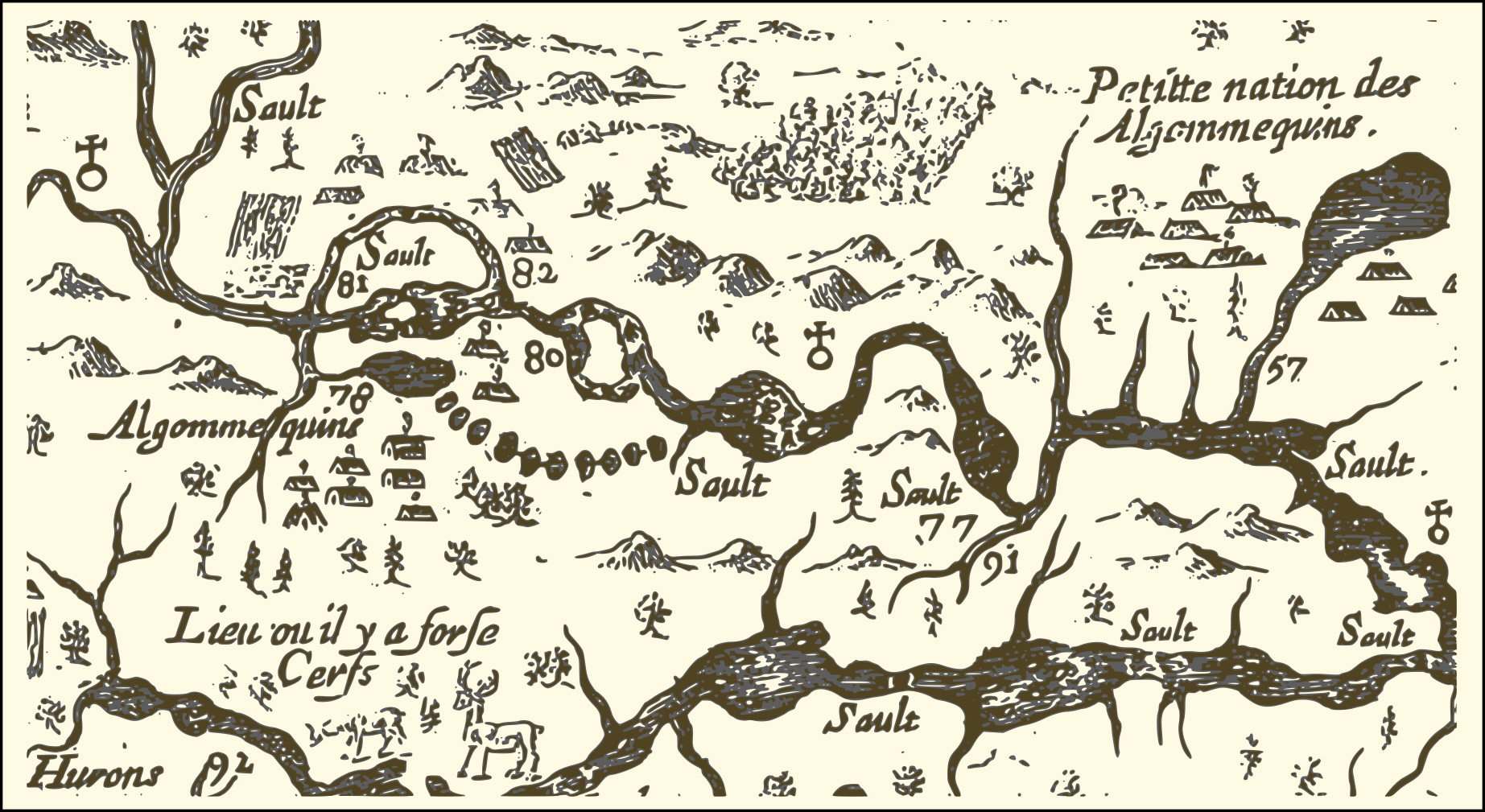
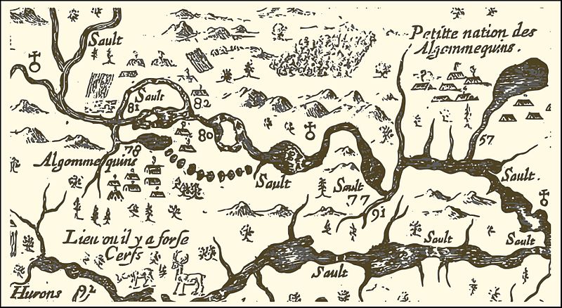
English: An extract from a map of the eastern reaches of New France, showing a portion of the Ottawa River. The map was created in 1632 by Samuel de Champlain to show the route he took in 1616, with numbers used to indicate sites he visisted, significant rapids and aboriginal encampments. In particular,
Français : Carte de l'est de la Nouvelle-France par Samuel de Champlain (1632) - extrait de la portion de la rivière des Outaouais. Champlain fait graver en France en 1632 une carte de son trajet réalisé en 1616 sur laquelle il indique à l'aide de chiffres, certains sites visités, des saults (rapides) importants ou des campements indiens.
|
||||
| 日期 | |||||
| 來源 | http://gallica.bnf.fr/ark:/12148/btv1b6700076h/ | ||||
| 作者 | Samuel de Champlain | ||||
| 授權許可 (重用此檔案) |
|
檔案歷史
點選日期/時間以檢視該時間的檔案版本。
| 日期/時間 | 縮圖 | 尺寸 | 用戶 | 備註 | |
|---|---|---|---|---|---|
| 目前 | 2016年8月31日 (三) 04:20 | | 1,845 × 1,009(936 KB) | Pierre5018 | vectorisation et conversion png |
| 2016年8月31日 (三) 03:07 |  | 888 × 482(152 KB) | Pierre5018 | nouvelle source: Gallica ark:/12148/btv1b6700076h | |
| 2007年1月7日 (日) 01:21 |  | 1,006 × 497(170 KB) | Jljmt | Carte de l'est de la Nouvelle-France par Samuel de Champlain 1632 extrait de la portion de la rivière des Outaouais | |
| 2007年1月6日 (六) 23:50 |  | 1,006 × 497(171 KB) | Jljmt | Carte de l'est de la Nouvelle-France par Samuel de Champlain 1632 extrait de la portion de la rivière des Outaouais |
檔案用途
下列頁面有用到此檔案:
全域檔案使用狀況
以下其他 wiki 使用了這個檔案:
- ca.wikipedia.org 的使用狀況
- en.wikipedia.org 的使用狀況
- fr.wikipedia.org 的使用狀況
- it.wikipedia.org 的使用狀況