
File:Fernanda 2017-07-14 2135Z.jpg

預覽大小:450 × 600 像素。 其他解析度:180 × 240 像素 | 360 × 480 像素 | 576 × 768 像素 | 768 × 1,024 像素 | 1,536 × 2,048 像素 | 6,300 × 8,400 像素。
原始檔案 (6,300 × 8,400 像素,檔案大小:13.46 MB,MIME 類型:image/jpeg)
摘要
| 描述 |
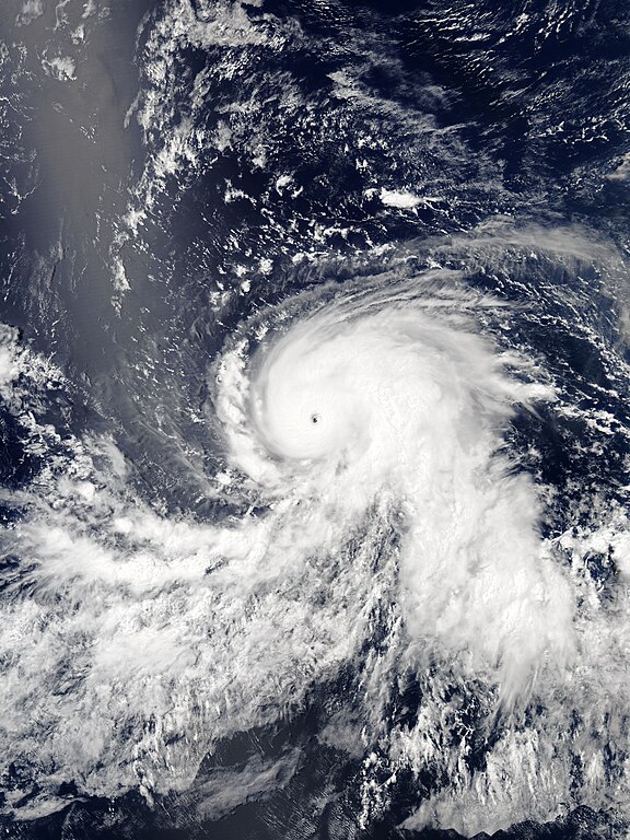
English: Hurricane Fernanda as a Category 4 hurricane over the Northeast Pacific Ocean late on July 14, 2017. |
| 日期 | |
| 來源 | EOSDIS Worldview |
| 作者 | MODIS image captured by NASA’s Aqua satellite |
| 拍攝地點 | | 位於此地的本圖片與其他圖片: OpenStreetMap |
|---|
授權條款
| 本作品由NASA創作,屬於公有領域。根據NASA的版權政策:“NASA的創作除非另有聲明否則不受版權保護。”(參見:Template:PD-USGov/zh,NASA版權政策或JPL圖像使用政策) | ||
 |
警告:
|
檔案歷史
點選日期/時間以檢視該時間的檔案版本。
| 日期/時間 | 縮圖 | 尺寸 | 用戶 | 備註 | |
|---|---|---|---|---|---|
| 目前 | 2018年10月20日 (六) 07:37 | | 6,300 × 8,400(13.46 MB) | Nino Marakot | Reverted to version as of 01:50, 15 July 2017 (UTC) - looks blur due to over/under cropping. This is the original and it's pretty good |
| 2017年7月26日 (三) 10:51 |  | 5,796 × 7,757(8.59 MB) | ChocolateTrain | Storm a bit more centered with good proportions | |
| 2017年7月15日 (六) 01:50 |  | 6,300 × 8,400(13.46 MB) | Meow | Full size and optimised under the best standards. | |
| 2017年7月15日 (六) 01:30 |  | 5,200 × 6,400(14.63 MB) | TheAustinMan | User created page with UploadWizard |
檔案用途
下列頁面有用到此檔案:
全域檔案使用狀況
以下其他 wiki 使用了這個檔案:
- en.wikipedia.org 的使用狀況
- es.wikipedia.org 的使用狀況
- fr.wikipedia.org 的使用狀況
- ko.wikipedia.org 的使用狀況
- pt.wikipedia.org 的使用狀況
- vi.wikipedia.org 的使用狀況
- www.wikidata.org 的使用狀況