
File:Karte konstanz in deutschland.png
此為最大尺寸。
Karte_konstanz_in_deutschland.png (188 × 235 像素,檔案大小:5 KB,MIME 類型:image/png)
摘要
| 描述 |
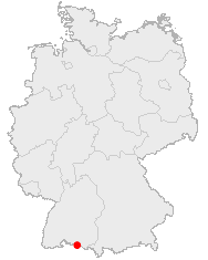
Deutsch: Karte von Deutschland mit den Grenzen der 16 Bundesländer
Quadratische Plattkarte, N-S-Streckung 150 %. Geographische Begrenzung der Karte:
English: Map of Germany with the borders of the 16 federal states
Equirectangular projection, N/S stretching 150 %. Geographic limits of the map:
|
| 日期 | |
| 來源 | 自己的作品 |
| 作者 | NordNordWest |
| 授權許可 (重用此檔案) |
|
| 其他版本 |
|


|
|
檔案歷史
點選日期/時間以檢視該時間的檔案版本。
| 日期/時間 | 縮圖 | 尺寸 | 用戶 | 備註 | |
|---|---|---|---|---|---|
| 目前 | 2005年12月23日 (五) 05:52 | | 188 × 235(5 KB) | Roo72 | from de Wiki category:maps |
檔案用途
下列頁面有用到此檔案:
全域檔案使用狀況
以下其他 wiki 使用了這個檔案:
- af.wikipedia.org 的使用狀況
- ja.wikipedia.org 的使用狀況
- pl.wikivoyage.org 的使用狀況