
File:Location of Pu'er Prefecture within Yunnan (China).png

預覽大小:800 × 591 像素。 其他解析度:320 × 236 像素 | 640 × 473 像素 | 880 × 650 像素。
原始檔案 (880 × 650 像素,檔案大小:100 KB,MIME 類型:image/png)
.png?uselang=zh-hk)
.png?uselang=zh-hk)
.png?action=history&uselang=zh-hk)
.png)
摘要
| 描述 |
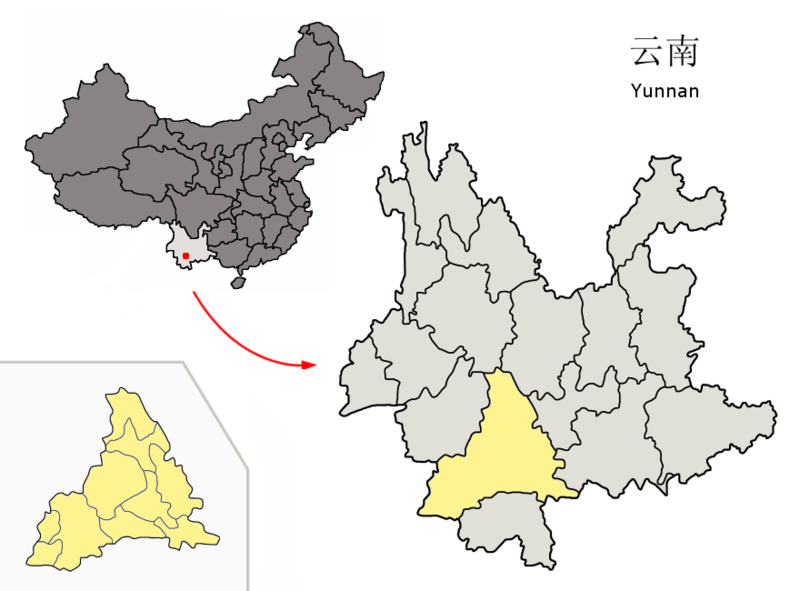
Location of Pu'er Prefecture (yellow) within Yunnan province of China Map drawn in september 2007 using various sources, mainly : |
| 日期 | |
| 來源 | 自己的作品 |
| 作者 | Croquant |
授權條款
我,本作品的著作權持有者,決定用以下授權條款發佈本作品:
此檔案採用創用CC 姓名標示 3.0 未在地化版本授權條款。
- 您可以自由:
- 分享 – 複製、發佈和傳播本作品
- 重新修改 – 創作演繹作品
- 惟需遵照下列條件:
- 姓名標示 – 您必須指名出正確的製作者,和提供授權條款的連結,以及表示是否有對內容上做出變更。您可以用任何合理的方式來行動,但不得以任何方式表明授權條款是對您許可或是由您所使用。
檔案歷史
點選日期/時間以檢視該時間的檔案版本。
| 日期/時間 | 縮圖 | 尺寸 | 用戶 | 備註 | |
|---|---|---|---|---|---|
| 目前 | 2007年9月26日 (三) 09:05 | | 880 × 650(100 KB) | Croquant | background cleaned |
| 2007年9月25日 (二) 18:20 |  | 880 × 650(100 KB) | Croquant | == Summary == {{Information |Description=Location of Pu'er Prefecture (yellow) within Yunnan province of China Map drawn in september 2007 using various sources, mainly : * [http://sedac.ciesin.org/china/admin/bnd90/t5390.html Yunnan province administrat |
檔案用途
下列頁面有用到此檔案:
全域檔案使用狀況
以下其他 wiki 使用了這個檔案:
- ar.wikipedia.org 的使用狀況
- da.wikipedia.org 的使用狀況
- de.wikipedia.org 的使用狀況
- en.wikivoyage.org 的使用狀況
- et.wikipedia.org 的使用狀況
- eu.wikipedia.org 的使用狀況
- fi.wikipedia.org 的使用狀況
- fr.wikipedia.org 的使用狀況
- Pu'er
- Xian autonome hani et yi de Ning'er
- Xian autonome hani de Mojiang
- Xian autonome yi, hani et lahu de Zhenyuan
- Xian autonome hani et yi de Jiangcheng
- Xian autonome dai, lahu et va de Menglian
- Xian autonome lahu de Lancang
- Xian autonome va de Ximeng
- Xian autonome yi de Jingdong
- Xian autonome dai et yi de Jinggu
- District de Simao
- Modèle:Palette Pu'er
- hak.wikipedia.org 的使用狀況
- it.wikipedia.org 的使用狀況
- ja.wikipedia.org 的使用狀況
- ko.wikipedia.org 的使用狀況
- nl.wikipedia.org 的使用狀況
- nn.wikipedia.org 的使用狀況
- no.wikipedia.org 的使用狀況
- pl.wikipedia.org 的使用狀況
- ru.wikipedia.org 的使用狀況
- sv.wikipedia.org 的使用狀況
- th.wikipedia.org 的使用狀況
- ug.wikipedia.org 的使用狀況
- uk.wikipedia.org 的使用狀況
- vi.wikipedia.org 的使用狀況
- www.wikidata.org 的使用狀況
- zh-classical.wikipedia.org 的使用狀況
- zh-min-nan.wikipedia.org 的使用狀況
- zh-yue.wikipedia.org 的使用狀況
.png)