
File:Map of Colorado counties, labelled.svg

此 SVG 檔案的 PNG 預覽的大小:800 × 579 像素。 其他解析度:320 × 232 像素 | 640 × 463 像素 | 1,024 × 741 像素 | 1,280 × 926 像素 | 2,560 × 1,853 像素 | 6,233 × 4,511 像素。
原始檔案 (SVG 檔案,表面大小:6,233 × 4,511 像素,檔案大小:635 KB)
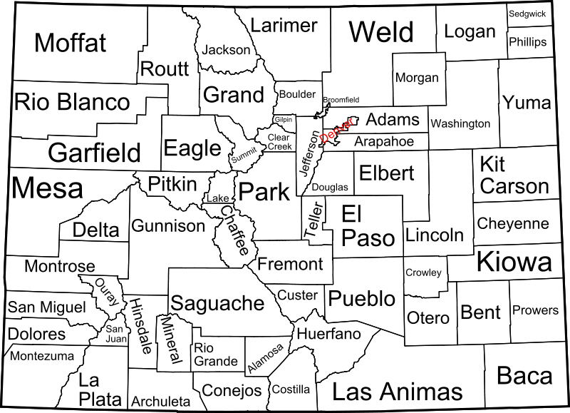
A map of Colorado, with county outlines and names. This is a modification of Image:Map of Colorado counties, blank.svg. See that page for information about the map.
David Benbennick made this map. I release all rights to it.
| 我,此作品的版權所有人,釋出此作品至公共領域。此授權條款在全世界均適用。 這可能在某些國家不合法,如果是的話: 我授予任何人有權利使用此作品於任何用途,除受法律約束外,不受任何限制。 |
檔案歷史
點選日期/時間以檢視該時間的檔案版本。
| 日期/時間 | 縮圖 | 尺寸 | 用戶 | 備註 | |
|---|---|---|---|---|---|
| 目前 | 2009年2月12日 (四) 09:13 | | 6,233 × 4,511(635 KB) | Retro00064 | Changed text to paths to attempt to remove grainyness when scaled down. |
| 2005年10月16日 (日) 05:06 |  | 6,233 × 4,511(192 KB) | Dbenbenn | by me, PD |
檔案用途
下列頁面有用到此檔案:
全域檔案使用狀況
以下其他 wiki 使用了這個檔案:
- ast.wikipedia.org 的使用狀況
- de.wikipedia.org 的使用狀況
- el.wikipedia.org 的使用狀況
- en.wikipedia.org 的使用狀況
- fi.wikipedia.org 的使用狀況
- frr.wikipedia.org 的使用狀況
- fr.wikipedia.org 的使用狀況
- he.wikipedia.org 的使用狀況
- it.wikipedia.org 的使用狀況
- ja.wikipedia.org 的使用狀況
- li.wikipedia.org 的使用狀況
- nds.wikipedia.org 的使用狀況
- nl.wikipedia.org 的使用狀況
- pa.wikipedia.org 的使用狀況
- pt.wikipedia.org 的使用狀況
- ro.wikipedia.org 的使用狀況
- sv.wikipedia.org 的使用狀況
- vi.wikipedia.org 的使用狀況