
File:NeueLaender.png
預覽大小:472 × 599 像素。 其他解析度:189 × 240 像素 | 378 × 480 像素 | 774 × 983 像素。
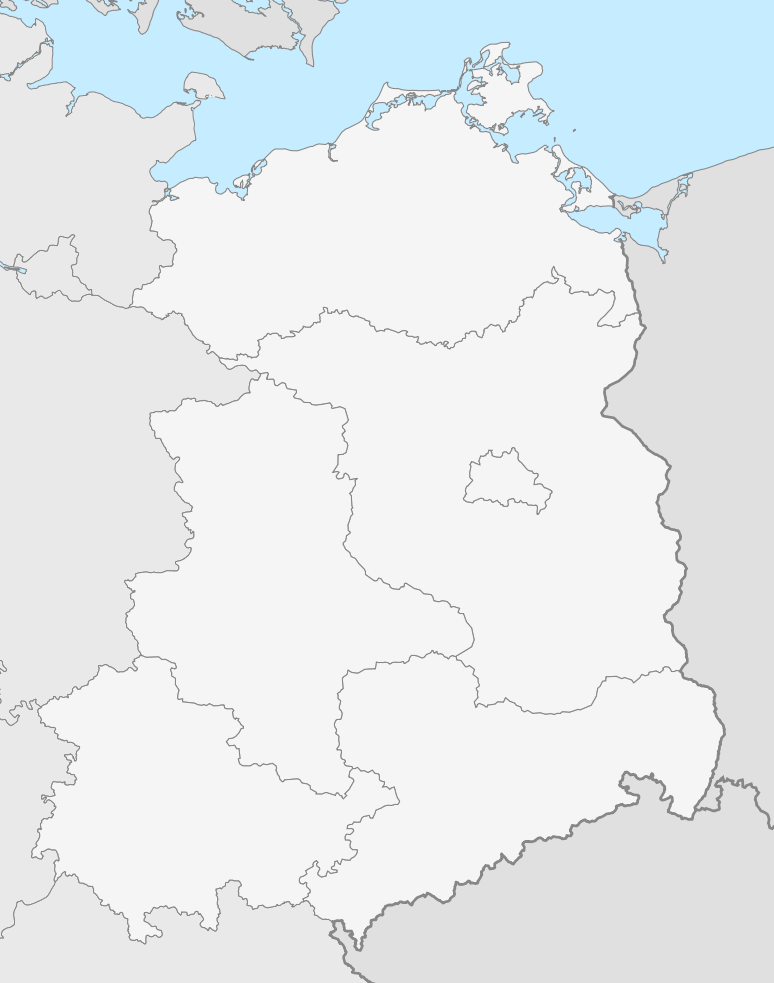
原始檔案 (774 × 983 像素,檔案大小:90 KB,MIME 類型:image/png)
摘要
| 描述 |
Deutsch: Karte der Neuen Bundesländer mit den Grenzen der Bundesländer Quadratische Plattkarte, N-S-Streckung 150 %. English: Map of New Länder with the borders of the federal states Equirectangular projection, N/S stretching 150 %. |
|||
| 日期 | (UTC) | |||
| 來源 | ||||
| 作者 |
|
|||
| 其他版本 |
|


| 這是一張修飾過的圖片,即本圖片是用軟體修改過後的版本,修改的方式或內容有:coloured, zoomed。原版圖片來源:Deutschland.svg。修改者:Xantener。
|
授權條款
我,本作品的著作權持有者,決定用以下授權條款發佈本作品:
此檔案採用共享創意 姓名標示-相同方式分享 3.0 未在地化版本授權條款。
- 您可以自由:
- 分享 – 複製、發佈和傳播本作品
- 重新修改 – 創作演繹作品
- 惟需遵照下列條件:
- 姓名標示 – 您必須指名出正確的製作者,和提供授權條款的連結,以及表示是否有對內容上做出變更。您可以用任何合理的方式來行動,但不得以任何方式表明授權條款是對您許可或是由您所使用。
- 相同方式分享 – 如果您利用本素材進行再混合、轉換或創作,您必須基於如同原先的相同或兼容的條款,來分布您的貢獻成品。

|
已授權您依據自由軟體基金會發行的無固定段落、封面文字和封底文字GNU自由文件授權條款1.2版或任意後續版本,對本檔進行複製、傳播和/或修改。該協議的副本列在GNU自由文件授權條款中。 |
您可以選擇您需要的授權條款。
原始上傳日誌
This image is a derivative work of the following images:
- Image:Deutschland.svg licensed with Cc-by-sa-3.0, GFDL
- 2008-07-02T13:18:14Z NordNordWest 1343x1591 (752913 Bytes) colours corrected
- 2008-05-28T09:29:49Z NordNordWest 1343x1591 (750990 Bytes) corrected
- 2008-05-27T21:15:33Z NordNordWest 1343x1591 (673369 Bytes) brighter version
- 2008-05-27T19:51:19Z NordNordWest 1343x1591 (668332 Bytes)
- 2008-05-27T19:40:49Z NordNordWest 537x636 (665409 Bytes) {{Information |Description= {{de|Karte von [[:de:Deutschland|Deutschland]] mit den Grenzen der 16 Bundesländer}} {{en|Map of [[:en:Germany|Germany]] with the borders of the 16 federal states}} |Source=own work |Date=27-05-20
Uploaded with derivativeFX
檔案歷史
點選日期/時間以檢視該時間的檔案版本。
| 日期/時間 | 縮圖 | 尺寸 | 用戶 | 備註 | |
|---|---|---|---|---|---|
| 目前 | 2008年7月19日 (六) 11:01 | | 774 × 983(90 KB) | Xantener | {{Information |Description= |Source= |Date= |Author= |Permission= |other_versions= }} |
| 2008年7月19日 (六) 10:56 |  | 1,343 × 1,591(6.12 MB) | Xantener | {{Information |Description={{de|Karte der Neuen Bundesländer mit den Grenzen der Bundesländer}} Quadratische Plattkarte, N-S-Streckung 150 %. {{en|Map of New Länder with the borders of the federal states}} |
檔案用途
下列頁面有用到此檔案:
全域檔案使用狀況
以下其他 wiki 使用了這個檔案:
- ar.wikipedia.org 的使用狀況
- de.wikipedia.org 的使用狀況
- Neue Länder
- Fußball-Oberliga Nordost 2006/07
- Fußball-Oberliga Nordost 2005/06
- Fußball-Oberliga Nordost 2004/05
- Fußball-Oberliga Nordost 2003/04
- Benutzer:HeRoLE/OLNO
- Vorlage:Positionskarte Deutschland Neue Bundesländer
- Fußball-Oberliga Nordost 2002/03
- Benutzer:HeRoLE/NOFV
- Wikipedia:Kartenwerkstatt/Positionskarten/Europa
- Fußball-Oberliga Nordost 1996/97
- Fußball-Oberliga Nordost 2001/02
- Fußball-Oberliga Nordost 2000/01
- Fußball-Oberliga Nordost 1999/2000
- Fußball-Oberliga Nordost 1998/99
- de.wiktionary.org 的使用狀況
- en.wikipedia.org 的使用狀況
- es.wikipedia.org 的使用狀況
- fa.wikipedia.org 的使用狀況
- it.wikipedia.org 的使用狀況
- ja.wikipedia.org 的使用狀況
- ko.wikipedia.org 的使用狀況
- lmo.wikipedia.org 的使用狀況
- nl.wikipedia.org 的使用狀況
- pl.wikipedia.org 的使用狀況
- pt.wikipedia.org 的使用狀況
- ro.wikipedia.org 的使用狀況
- ru.wikipedia.org 的使用狀況
- th.wikipedia.org 的使用狀況
- tr.wikipedia.org 的使用狀況
- www.wikidata.org 的使用狀況