
File:Historische kaart Vijfheerenlanden (16e eeuw).jpg
預覽大小:630 × 599 像素。 其他解析度:252 × 240 像素 | 505 × 480 像素 | 808 × 768 像素 | 1,077 × 1,024 像素 | 2,154 × 2,048 像素 | 2,953 × 2,808 像素。
原始檔案 (2,953 × 2,808 像素,檔案大小:5.68 MB,MIME 類型:image/jpeg)
.jpg?uselang=zh-mo)
.jpg?uselang=zh-mo)
.jpg?action=history&uselang=zh-mo)
.jpg)
| 描述 |
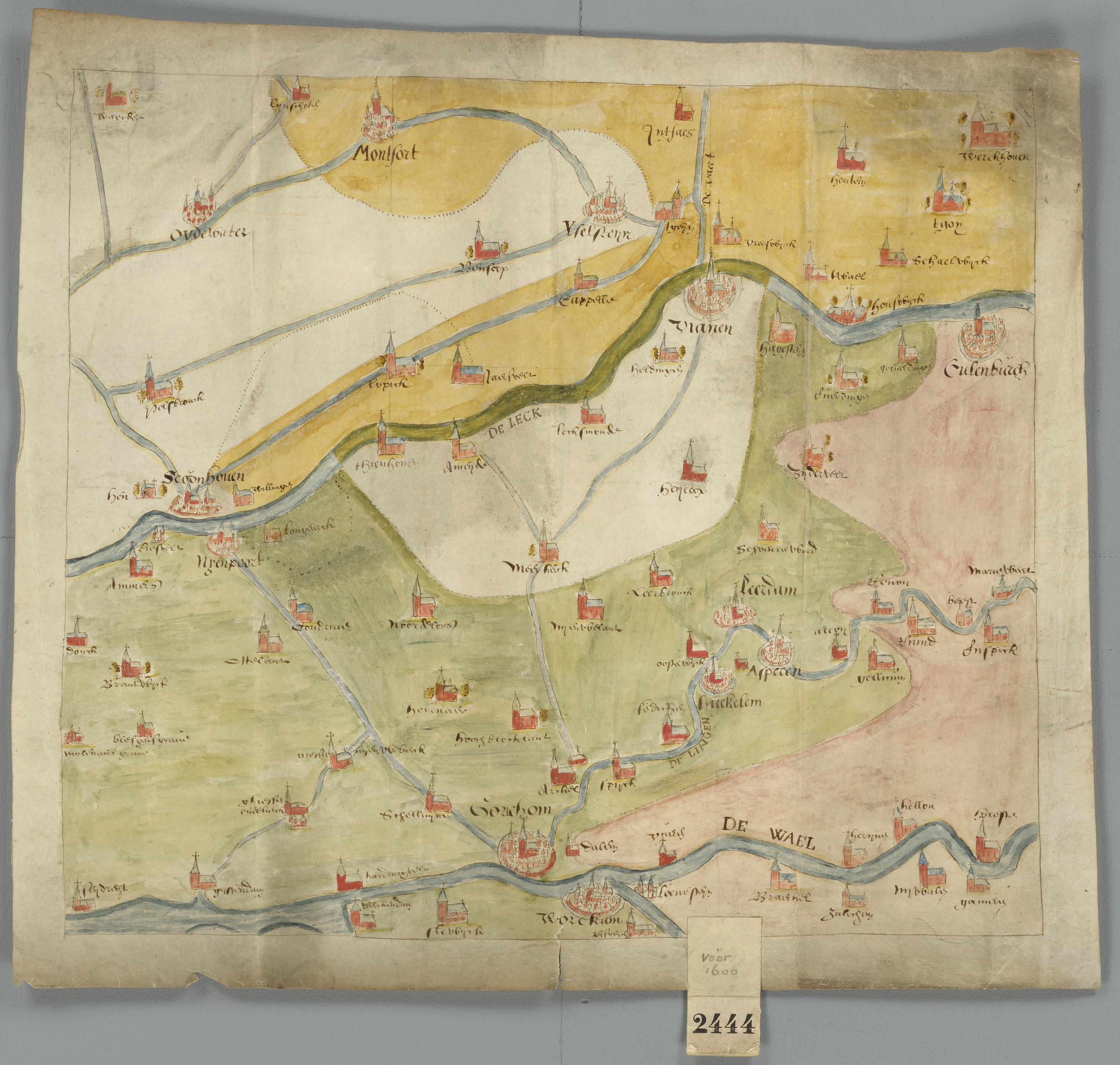
Kaart van de Vijfheerenlanden en de aangrenzende landen, uit de 16de eeuw Deze kaart is onderdeel van de Verzameling Binnenlandse Kaarten Hingman. Deze collectie is door het Provinciaal Historisch Centrum Zuid-Holland gedigitaliseerd, ten behoeve van de website www.geschiedenisvanzuidholland.nl. De collectie wordt bewaard bij het Nationaal Archief. |
||||||
| 日期 | 16世紀 | ||||||
| 來源 | Flickr: Historische kaart Vijfheerenlanden (16e eeuw) | ||||||
| 作者 | Provinciaal Historisch Centrum Zuid-Holland | ||||||
| 授權許可 (重用此檔案) |
|
||||||
| 註解 | 該圖片含有註解:在維基媒體共享資源上查看註解 |
.jpg)
檔案歷史
點選日期/時間以檢視該時間的檔案版本。
| 日期/時間 | 縮圖 | 尺寸 | 用戶 | 備註 | |
|---|---|---|---|---|---|
| 目前 | 2017年10月20日 (五) 21:55 | | 2,953 × 2,808(5.68 MB) | VortBot | Uploading higher resolution from Flickr |
| 2012年12月30日 (日) 11:01 |  | 1,024 × 974(558 KB) | Flickr upload bot | Uploaded from http://flickr.com/photo/32562899@N06/3874176206 using Flickr upload bot |
檔案用途
下列頁面有用到此檔案:
全域檔案使用狀況
以下其他 wiki 使用了這個檔案:
- ar.wikipedia.org 的使用狀況
- en.wikipedia.org 的使用狀況
- fa.wikipedia.org 的使用狀況
- fr.wikipedia.org 的使用狀況
- id.wikipedia.org 的使用狀況
- nl.wikipedia.org 的使用狀況
.jpg)