
File:Hurricane Maria September 6 2005.jpg

預覽大小:600 × 600 像素。 其他解析度:240 × 240 像素 | 480 × 480 像素 | 768 × 768 像素 | 1,024 × 1,024 像素 | 2,048 × 2,048 像素 | 6,000 × 6,000 像素。
原始檔案 (6,000 × 6,000 像素,檔案大小:4.99 MB,MIME 類型:image/jpeg)
摘要
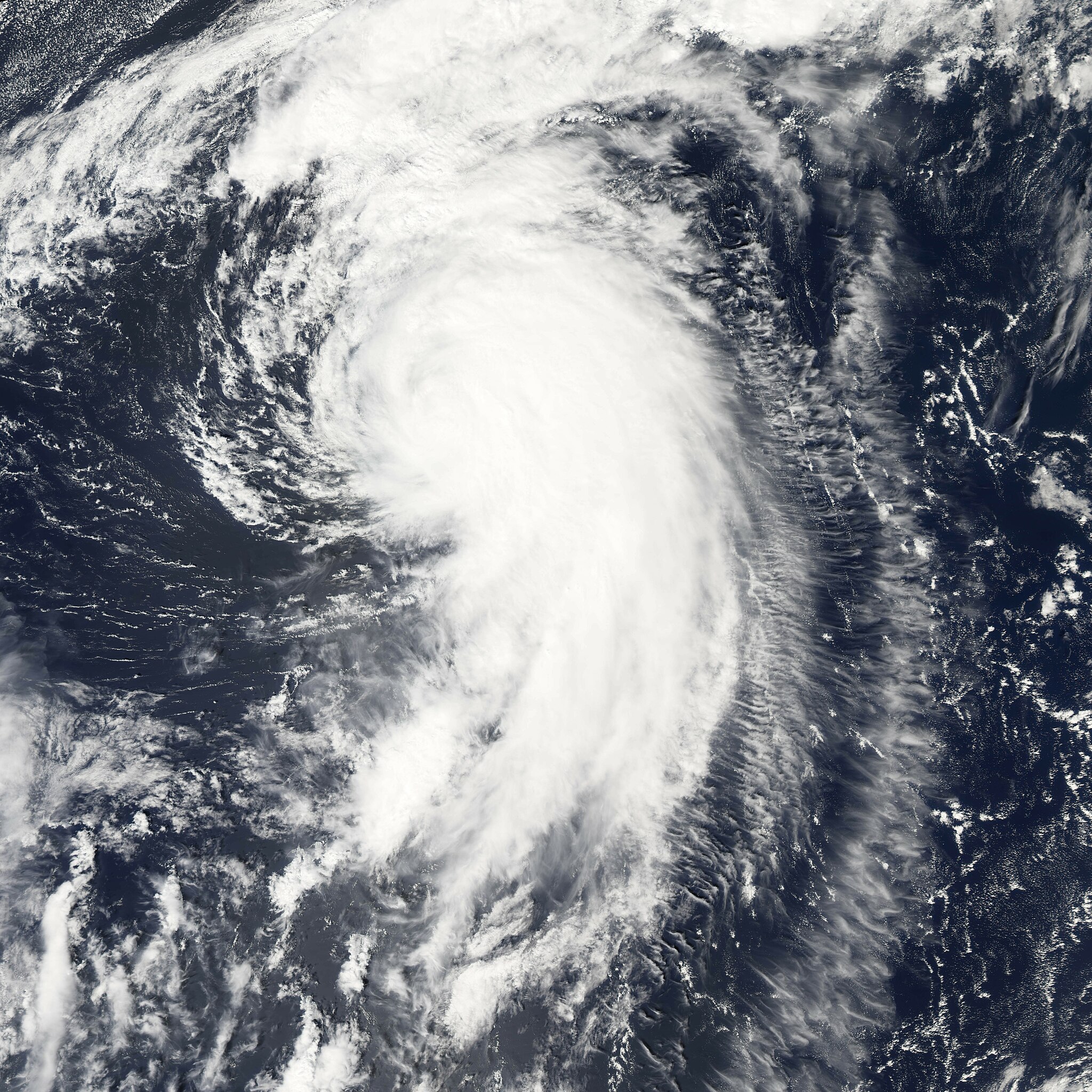
| 描述 | Hurricane Maria is spinning north over the Atlantic Ocean, well away from land. The storm reached its maximum intensity on September 6, 2005, several hours before the Moderate Resolution Imaging Spectroradiometer (MODIS) on NASA’s Aqua satellite captured this image at 1:45 ADT (16:45 UTC). At this time, the storm had winds of about 160 kilometers per hour (100 miles per hour) with gusts to 195 km/hr (120 mph), down from its previous intensity of 185 km/hr (115 mph) with gusts to 220 km/hr (140 mph). Maria is expected to continue to weaken as it moves north. It is not forecast to affect land. | |||||
| 日期 | ||||||
| 來源 | http://earthobservatory.nasa.gov/NaturalHazards/natural_hazards_v2.php3?img_id=13107 | |||||
| 作者 | NASA image created by Jesse Allen, Earth Observatory, using data provided courtesy of the MODIS Rapid Response team. | |||||
| 授權許可 (重用此檔案) |
|

檔案歷史
點選日期/時間以檢視該時間的檔案版本。
| 日期/時間 | 縮圖 | 尺寸 | 用戶 | 備註 | |
|---|---|---|---|---|---|
| 目前 | 2006年7月29日 (六) 17:52 | | 6,000 × 6,000(4.99 MB) | Good kitty | |
| 2006年1月8日 (日) 03:13 |  | 1,500 × 1,500(802 KB) | Jdorje~commonswiki | ||
| 2005年9月7日 (三) 21:08 |  | 6,000 × 6,000(3.2 MB) | Tom | {{PD-USGov-NASA}} Hurricane Maria spinning north over the Atlantic Ocean, well away from land. The storm reached its maximum intensity on September 6, 2005, several hours before the Moderate Resolution Imaging Spectroradiometer (MOD |
檔案用途
下列5個頁面有用到此檔案:
全域檔案使用狀況
以下其他 wiki 使用了這個檔案:
- de.wikipedia.org 的使用狀況
- en.wikipedia.org 的使用狀況
- eo.wikipedia.org 的使用狀況
- es.wikipedia.org 的使用狀況
- eu.wikipedia.org 的使用狀況
- fr.wikipedia.org 的使用狀況
- pt.wikipedia.org 的使用狀況
- simple.wikipedia.org 的使用狀況
- sv.wikinews.org 的使用狀況
- www.wikidata.org 的使用狀況