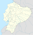
File:Ecuador location map.svg

此 SVG 檔案的 PNG 預覽的大小:556 × 599 像素。 其他解析度:223 × 240 像素 | 445 × 480 像素 | 713 × 768 像素 | 950 × 1,024 像素 | 1,901 × 2,048 像素 | 1,535 × 1,654 像素。
原始檔案 (SVG 檔案,表面大小:1,535 × 1,654 像素,檔案大小:1.03 MB)
檔案歷史
點選日期/時間以檢視該時間的檔案版本。
| 日期/時間 | 縮圖 | 尺寸 | 使用者 | 備註 | |
|---|---|---|---|---|---|
| 目前 | 2023年6月2日 (五) 23:57 |  | 1,535 × 1,654(1.03 MB) | Milenioscuro | code clean |
| 2023年4月18日 (二) 23:59 |  | 1,535 × 1,654(1.91 MB) | David C. S. | Límites | |
| 2023年4月18日 (二) 23:55 |  | 1,535 × 1,654(1.91 MB) | David C. S. | Límites y ríos | |
| 2023年4月3日 (一) 03:30 |  | 1,535 × 1,654(1.86 MB) | David C. S. | Límites | |
| 2023年3月30日 (四) 23:40 |  | 1,535 × 1,654(1.79 MB) | David C. S. | Límites y ríos | |
| 2023年3月24日 (五) 23:20 |  | 1,535 × 1,654(1.5 MB) | David C. S. | Límites y ríos | |
| 2023年2月13日 (一) 16:28 |  | 1,535 × 1,654(1.37 MB) | David C. S. | Límites y ríos | |
| 2018年5月1日 (二) 21:03 |  | 1,535 × 1,654(246 KB) | Janitoalevic | Added Payana island to Ecuador color. | |
| 2012年6月20日 (三) 18:48 |  | 1,535 × 1,654(242 KB) | NordNordWest | upd | |
| 2012年6月14日 (四) 16:28 |  | 1,535 × 1,654(231 KB) | NordNordWest | Reverted to version as of 10:28, 14 June 2012. See your talk page. Please do not change this map again. |
檔案用途
下列35個頁面有用到此檔案:
- 1947年南美足球錦標賽
- 1959年南美足球錦標賽 (厄瓜多爾)
- 1993年美洲國家盃
- 1995年國際足協U-17世界錦標賽
- 何塞·華金·德·奧爾梅多國際機場
- 克韋多 (厄瓜多爾)
- 卡诺阿
- 圣埃伦娜半岛
- 圣洛伦索 (厄瓜多尔)
- 埃斯梅拉達斯 (厄瓜多爾)
- 基多
- 奧雷亞納弗朗西斯科港
- 安巴托
- 巴劳 (厄瓜多尔)
- 昆卡 (厄瓜多尔)
- 普納島
- 曼塔
- 桑蓋國家公園
- 波索尔哈
- 洛佩斯港
- 特納
- 瓜亞基爾
- 科隆群岛
- 穆伊斯内
- 聖埃倫娜
- 聖多明各 (厄瓜多爾)
- 舊蘇克雷元帥國際機場
- 蘇克雷元帥國際機場
- 道莱
- 里奥贝尔德 (厄瓜多尔)
- 里奧班巴
- 阿塔卡梅斯
- Talk:1949年安巴托地震
- Template:Location map Ecuador
- Template:厄瓜多爾世界遺產
全域檔案使用狀況
以下其他 wiki 使用了這個檔案:
- af.wikipedia.org 的使用狀況
- an.wikipedia.org 的使用狀況
- ar.wikipedia.org 的使用狀況
- ast.wikipedia.org 的使用狀況
- Quitu
- Volcán Chimborazo
- Palaciu Llexislativu d'Ecuador
- Volcán Cotopaxi
- Módulu:Mapa de llocalización/datos/Ecuador
- Campeonatu Suramericanu 1947
- Copa América 1993
- Universidá Central del Ecuador
- Aeropuertu Chachoan - Ambato
- Aeropuertu Francisco de Orellana
- Aeropuertu General Manuel Serrano - Machala
- Aeropuertu Internacional Mariscal Sucre
- Aeropuertu José María Velasco Ibarra - Macará
- Aeropuertu Jumandy
- Aeropuertu Mayor Galo de la Torre
- Aeropuertu Río Amazonas
- Aeropuertu de Lago Agrio
- Antiguu Aeropuertu Internacional Mariscal Sucre
- Puertu de Manta
- Módulu:Mapa de llocalización/datos/Ecuador/usu
- Golfu de Guayaquil
- az.wikipedia.org 的使用狀況
- ban.wikipedia.org 的使用狀況
- be-tarask.wikipedia.org 的使用狀況
- be.wikipedia.org 的使用狀況
檢視此檔案的更多全域使用狀況。


