
File:Karte-Hohenzollern.png
預覽大小:782 × 600 像素。 其他解析度:313 × 240 像素 | 626 × 480 像素 | 1,002 × 768 像素 | 1,274 × 977 像素。
原始檔案 (1,274 × 977 像素,檔案大小:59 KB,MIME 類型:image/png)
| 描述 |
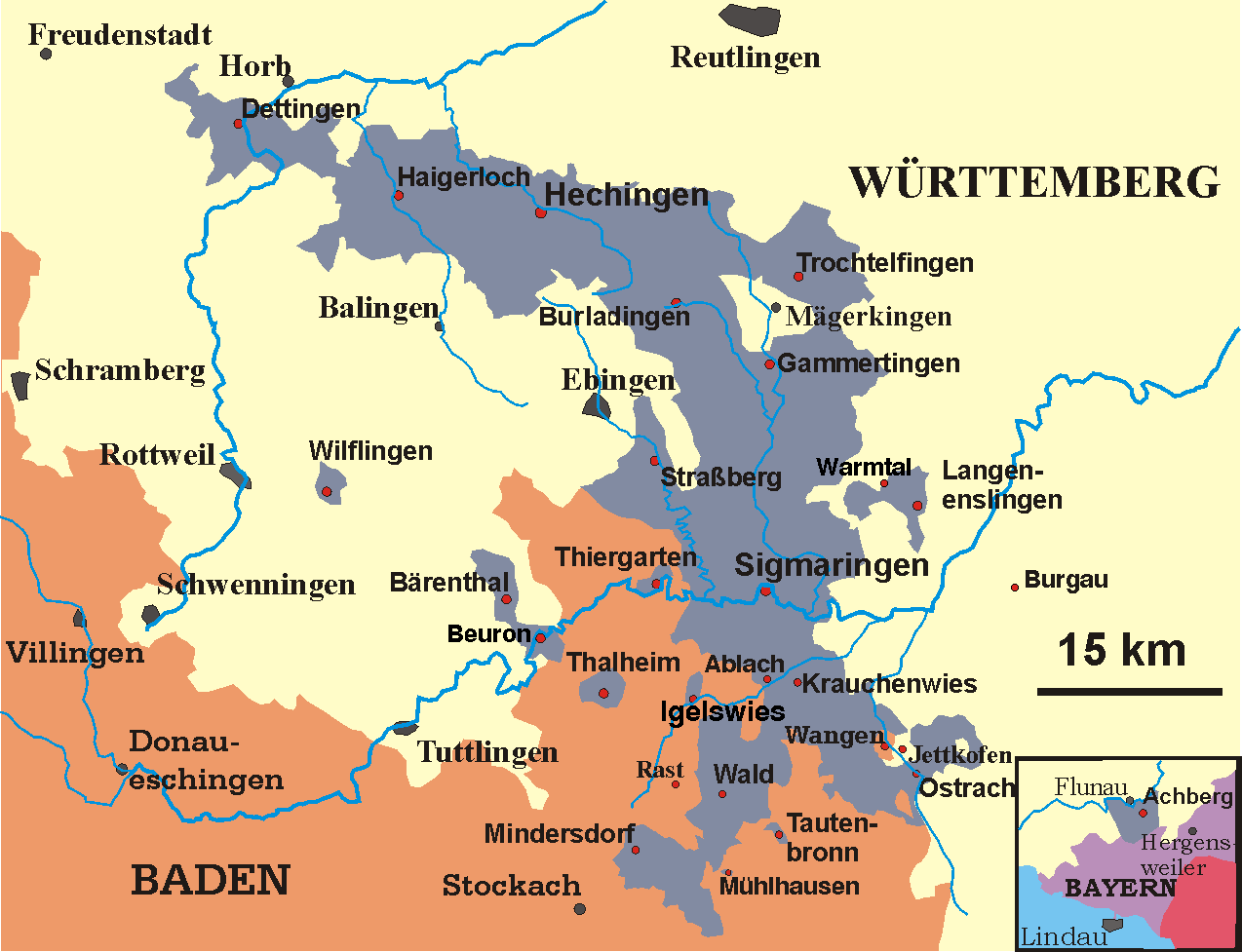
Deutsch: Karte der Hohenzollernschen Lande, Stand 1930
English: Map of the Prussian province of Hohenzollern, 1930 |
||
| 日期 | May 2005-December 2006 | ||
| 來源 | transferred from the German Wikipedia | ||
| 作者 | Störfix (original author), Ssch (modifications) | ||
| 授權許可 (重用此檔案) |
|
檔案歷史
點選日期/時間以檢視該時間的檔案版本。
| 日期/時間 | 縮圖 | 尺寸 | 使用者 | 備註 | |
|---|---|---|---|---|---|
| 目前 | 2009年10月1日 (四) 06:37 | | 1,274 × 977(59 KB) | Quartl | use brighter shade of blue to make texts better readable |
| 2007年2月13日 (二) 20:49 |  | 1,274 × 977(61 KB) | Ssch~commonswiki | {{Information| |Description = de: Karte der Hohenzollernschen Lande, Stand 1930<br/> en: Map of the Prussian province of Hohenzollern, 1930 |Source = transferred from the German Wikipedia |Date = May 2005-December 2006 |Author = de:User:Störfix (ori |
檔案用途
下列頁面有用到此檔案:
全域檔案使用狀況
以下其他 wiki 使用了這個檔案:
- als.wikipedia.org 的使用狀況
- ast.wikipedia.org 的使用狀況
- azb.wikipedia.org 的使用狀況
- be.wikipedia.org 的使用狀況
- ca.wikipedia.org 的使用狀況
- cs.wikipedia.org 的使用狀況
- de.wikipedia.org 的使用狀況
- Hohenzollern
- Hohenzollernsche Lande
- Sigmaringen
- Hechingen
- Wellendingen
- Achberg
- Hohenzollerische Landesbahn
- Schwäbische Hohenzollern
- Herrschaft Haigerloch
- Territoriale Besonderheiten in Südwestdeutschland nach 1810
- Wikipedia:Kartenwerkstatt/Archiv/2007-10
- Oberamt (Hohenzollern)
- Forschungsreaktor Haigerloch
- Thalheim (Leibertingen)
- Benutzer:QMRNMNN/Baustelle
- en.wikipedia.org 的使用狀況
- eo.wikipedia.org 的使用狀況
- es.wikipedia.org 的使用狀況
- fi.wikipedia.org 的使用狀況
- fr.wikipedia.org 的使用狀況
- fr.wiktionary.org 的使用狀況
- fy.wikipedia.org 的使用狀況
- gl.wikipedia.org 的使用狀況
- it.wikipedia.org 的使用狀況
- la.wikipedia.org 的使用狀況
- lt.wikipedia.org 的使用狀況
- mk.wikipedia.org 的使用狀況
- nl.wikipedia.org 的使用狀況
檢視此檔案的更多全域使用狀況。