
File:Manthokha Waterfalls.JPG
原始檔案 (5,184 × 3,456 像素,檔案大小:8.19 MB,MIME 類型:image/jpeg)
摘要
| 描述 |
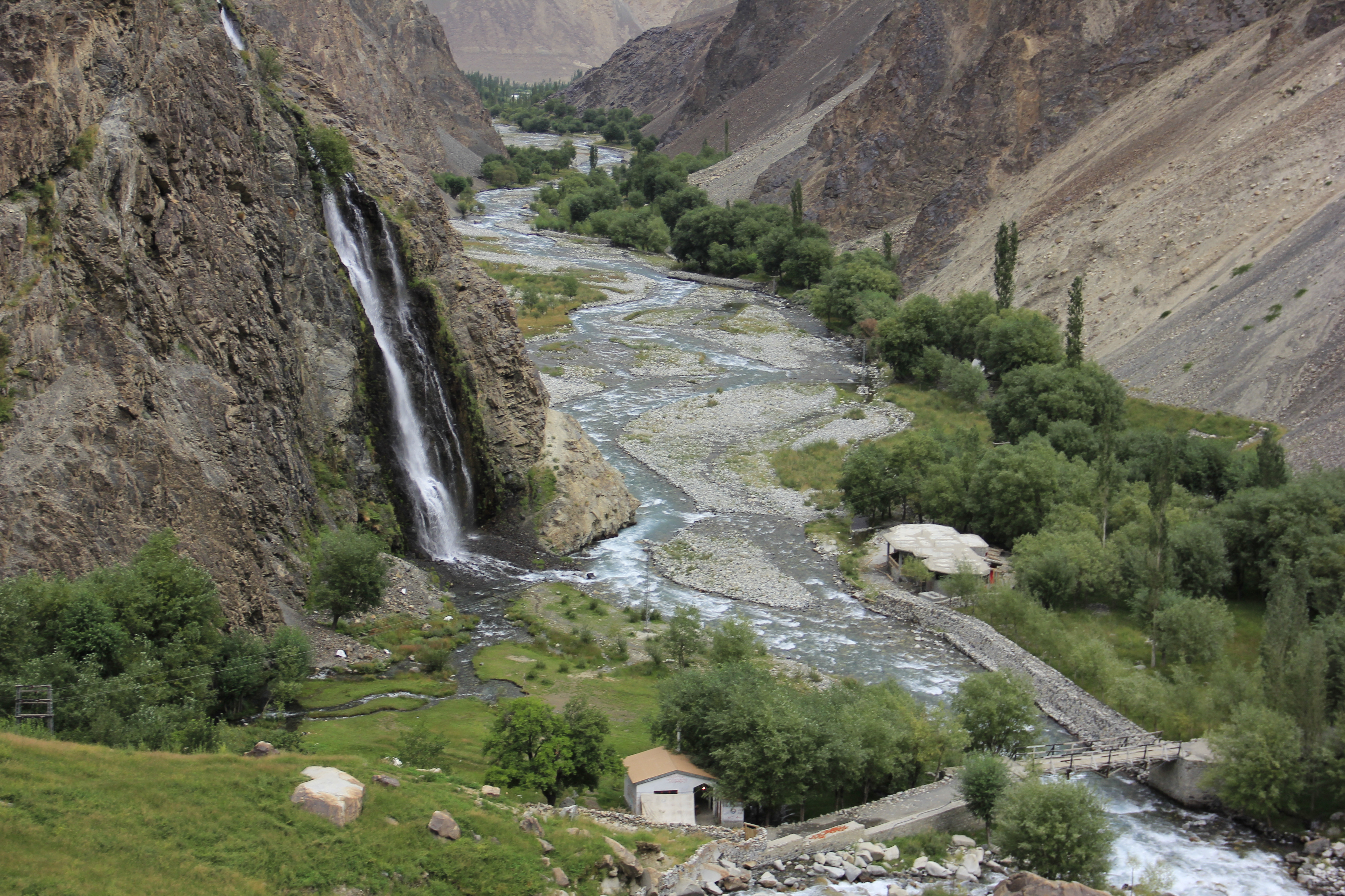
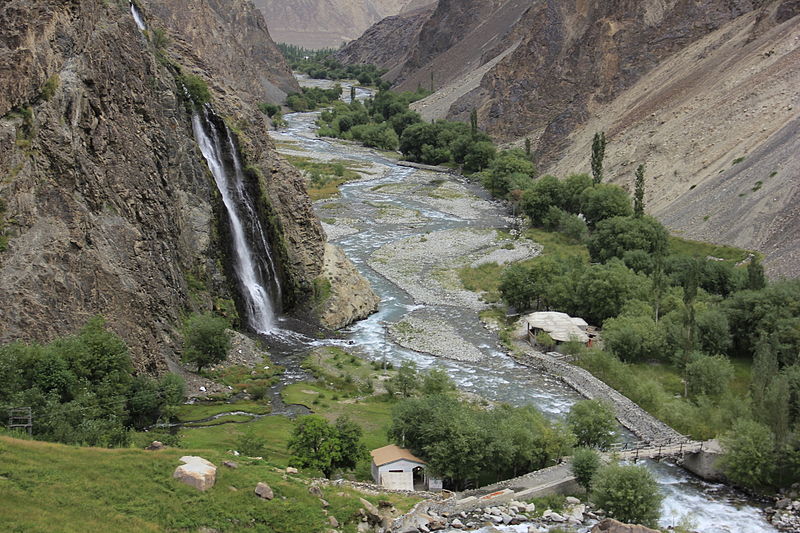
English: Manthokha waterfalls Located in the village of Manthokha Kharmang in District Skardu, Gilgit-Baltistan, this waterfall is famous for its picturesque and spectacular landscape. This is one of the main meccas of the district Skardu welcoming the native as well as international tourists.
The waterfall is in village Manthokha which can be accessed from Skardu city. Heading towards Manthokha Waterfall one has to follow the Kargil-Skardu road from Skardu city. While moving to Manthokha the following villages comes in the way on Kargil-Skardu road: Hussainabad, Thorgo, Parkutta, Ghasing and Manthokha. A stream running downstream falls into the Indus River at Manthokha village. On the east side of this stream is Madhupur, a raod Manthoka-Madhupur road shall lead you to your final destination, Manthokha Waterfall. How to Reached Manthokha WaterFalls Baltistan from Islamabad. By Air. The PIA flight 451 flies to Skardu from Islamabad daily at 10:00 am (usually). It’s a 45 minutes flight, which is well worth the price you pay. During the flight, if you are sitting on the right side, you will see some of the most beautiful mountain ranges from Nanga Parbat, Raka Poshi and also a distant view of the K2, the queen of all mountains.Skardu City is 10 miles from Skardu Airport and when you reached Skardu Bazar you will see Direction to Manthokha. By Road. Manthokha Waterfalls can be reached via Skardu by bus from Islamabad. The drive takes you all the way over the KKH (Karakoram Highway). Since the KKH is still under construction and the Skardu road still has to be repaired, the road can take up to 24 hours by public transport (cost approx. 2500 Rupees). Manthokha Valley is 60km from city of skardu. is located near the confluence of Indus rivers, and is watered by the stream flowing down the Manthokha Nala. Although Manthokha is the base camp for the routes to Sub Division Kharmang. |
| 日期 | |
| 來源 | 自己的作品 |
| 作者 | Rajab Saha |
| 拍攝地點 | | 位於此地的本圖片與其他圖片: OpenStreetMap |
|---|
Manthokha Waterfall, Skardu-16300
授權條款
- 您可以自由:
- 分享 – 複製、發佈和傳播本作品
- 重新修改 – 創作演繹作品
- 惟需遵照下列條件:
- 姓名標示 – 您必須指名出正確的製作者,和提供授權條款的連結,以及表示是否有對內容上做出變更。您可以用任何合理的方式來行動,但不得以任何方式表明授權條款是對您許可或是由您所使用。
- 相同方式分享 – 如果您利用本素材進行再混合、轉換或創作,您必須基於如同原先的相同或兼容的條款,來分布您的貢獻成品。
此圖片是維基愛地球2015的上傳作品。
|
 |
檔案歷史
點選日期/時間以檢視該時間的檔案版本。
| 日期/時間 | 縮圖 | 尺寸 | 使用者 | 備註 | |
|---|---|---|---|---|---|
| 目前 | 2015年5月22日 (五) 12:42 | | 5,184 × 3,456(8.19 MB) | Rajab Saha | User created page with UploadWizard |
檔案用途
下列頁面有用到此檔案:
全域檔案使用狀況
以下其他 wiki 使用了這個檔案:
- bn.wikipedia.org 的使用狀況
- en.wikipedia.org 的使用狀況
- hi.wikipedia.org 的使用狀況
- mr.wikipedia.org 的使用狀況
- ms.wikipedia.org 的使用狀況
- sl.wikipedia.org 的使用狀況