
File:SoCal megaregion.png
此為最大尺寸。
SoCal_megaregion.png (634 × 479 像素,檔案大小:116 KB,MIME 類型:image/png)
| 描述 |
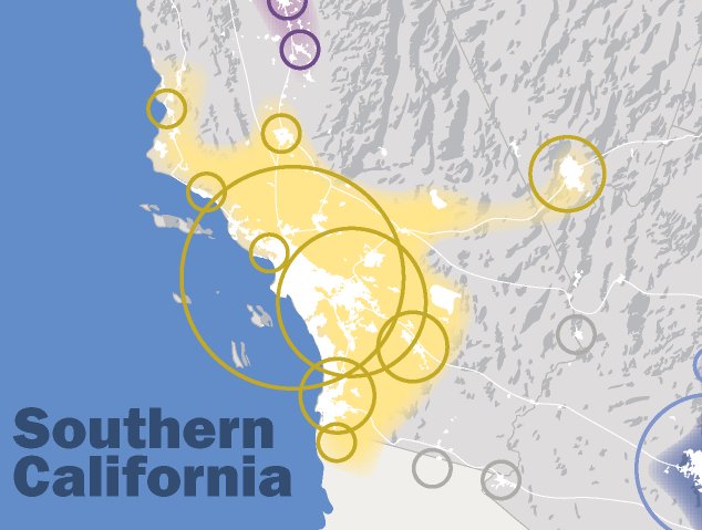
English: This map, created by the Regional Plan Association, illustrates the Southern California megaregion |
| 日期 | (UTC) |
| 來源 | |
| 作者 |
|
| 這是一張修飾過的圖片,即本圖片是用軟體修改過後的版本,修改的方式或內容有:Cropped to focus on the Southern California megraregion。原版圖片來源:MapofEmergingUSMegaregions.png。修改者:08OceanBeach SD。
|
我,本作品的著作權持有者,決定用以下授權條款發佈本作品:
此檔案採用創用CC 姓名標示-相同方式分享 3.0 未在地化版本授權條款。
- 您可以自由:
- 分享 – 複製、發佈和傳播本作品
- 重新修改 – 創作演繹作品
- 惟需遵照下列條件:
- 姓名標示 – 您必須指名出正確的製作者,和提供授權條款的連結,以及表示是否有對內容上做出變更。您可以用任何合理的方式來行動,但不得以任何方式表明授權條款是對您許可或是由您所使用。
- 相同方式分享 – 如果您利用本素材進行再混合、轉換或創作,您必須基於如同原先的相同或兼容的條款,來分布您的貢獻成品。
原始上傳日誌
This image is a derivative work of the following images:
- File:MapofEmergingUSMegaregions.png licensed with Cc-by-sa-3.0
- 2010-09-03T15:51:04Z Tryphon 1200x800 (625069 Bytes) Removed watermark.
- 2009-09-08T14:05:47Z IrvingPlNYC 1200x800 (665112 Bytes) {{Information |Description={{en|1=This map, created by the Regional Plan Association, illustrates eleven metropolitan areas that are growing into megaregions.}} |Source=Own work by uploader |Author=[[User:IrvingPlNYC|IrvingPl
Uploaded with derivativeFX
檔案歷史
點選日期/時間以檢視該時間的檔案版本。
| 日期/時間 | 縮圖 | 尺寸 | 使用者 | 備註 | |
|---|---|---|---|---|---|
| 目前 | 2011年3月5日 (六) 23:51 | | 634 × 479(116 KB) | 08OceanBeach SD | {{Information |Description={{en|1=This map, created by the Regional Plan Association, illustrates the Southern California megaregion}} |Source=*File:MapofEmergingUSMegaregions.png |Date=2011-03-05 23:49 (UTC) |Author=*[[:File:MapofEmergingUSMegaregi |
檔案用途
下列頁面有用到此檔案:
全域檔案使用狀況
以下其他 wiki 使用了這個檔案:
- cs.wikipedia.org 的使用狀況
- en.wikipedia.org 的使用狀況
- Los Angeles
- Santa Monica, California
- San Diego
- Las Vegas
- Southern California
- Huntington Beach, California
- Santa Ana, California
- Beverly Hills, California
- Anaheim, California
- Glendale, California
- Greater Los Angeles
- Long Beach, California
- Tijuana
- El Centro, California
- Burbank, California
- Carson, California
- Malibu, California
- Costa Mesa, California
- Garden Grove, California
- Corona, California
- Moreno Valley, California
- Riverside, California
- Fontana, California
- Ontario, California
- Rancho Cucamonga, California
- San Bernardino, California
- Carlsbad, California
- Chula Vista, California
- El Cajon, California
- Escondido, California
- Oceanside, California
- San Luis Obispo, California
- Santa Barbara, California
- Santa Maria, California
- Oxnard, California
- Henderson, Nevada
- North Las Vegas, Nevada
- Las Vegas Valley
- California megapolitan areas
- Irvine, California
- Santa Clarita, California
- San Diego–Tijuana
- Megaregions of the United States
- Tijuana metropolitan area
- Inland Empire
- Template:Southern California megaregion
- User:Nate.beisheim/sandbox10
- it.wikipedia.org 的使用狀況
- ml.wikipedia.org 的使用狀況
檢視此檔案的更多全域使用狀況。