
File:Urban heat island.svg

此 SVG 檔案的 PNG 預覽的大小:687 × 382 像素。 其他解析度:320 × 178 像素 | 640 × 356 像素 | 1,024 × 569 像素 | 1,280 × 712 像素 | 2,560 × 1,423 像素。
原始檔案 (SVG 檔案,表面大小:687 × 382 像素,檔案大小:252 KB)
| 描述 |
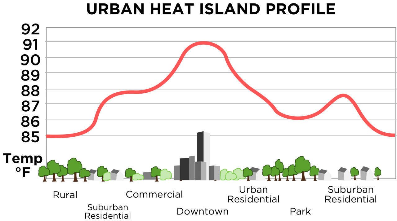
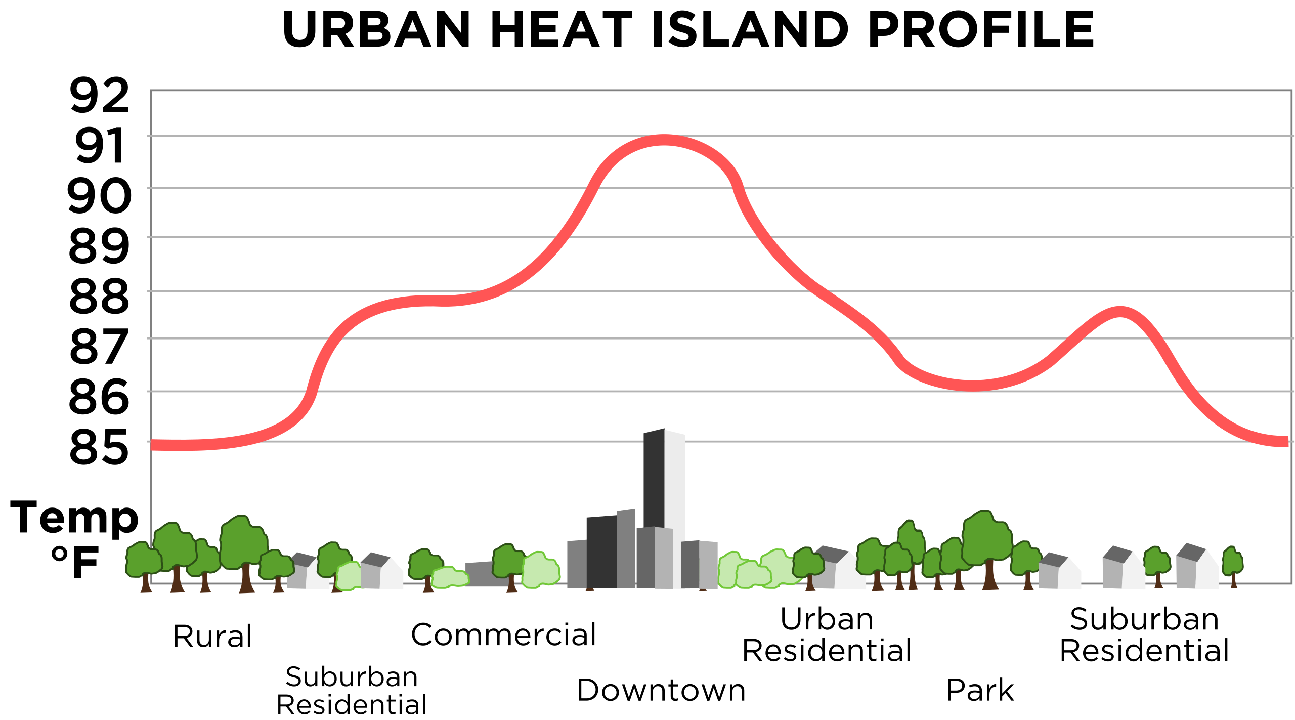
English: Vastly improved version of this, retraced in SVG. Original images source is this image from NOAA. |
|||
| 日期 | 11/23/08 | |||
| 來源 | 自己的作品 | |||
| 作者 | TheNewPhobia | |||
| 授權許可 (重用此檔案) |
|
|||
| 其他版本 | Derivative works of this file: Urban heat island (Celsius).png |
.png)
檔案歷史
點選日期/時間以檢視該時間的檔案版本。
| 日期/時間 | 縮圖 | 尺寸 | 使用者 | 備註 | |
|---|---|---|---|---|---|
| 目前 | 2008年11月23日 (日) 16:55 | | 687 × 382(252 KB) | TheNewPhobia | {{Information |Description={{en|1=Vastly improved version of this, retraced in SVG. Original images source is [http://www.crh.noaa.gov/images/lsx/recent_event/urban.gif this image] from NOAA.}} |Source=Own work by |
檔案用途
下列頁面有用到此檔案:
全域檔案使用狀況
以下其他 wiki 使用了這個檔案:
- en.wikipedia.org 的使用狀況
- fi.wikipedia.org 的使用狀況
- it.wikipedia.org 的使用狀況
- www.wikidata.org 的使用狀況