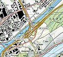
File:1150 Luzern.jpg

页面内容不支持其他语言。
這個文件來自維基共享資源
维基百科,自由的百科全书

原始文件(14,000 × 9,600像素,文件大小:110.74 MB,MIME类型:image/jpeg


摘要

警告 部分浏览器在浏览此图片的完整大小时可能会遇到困难:该图片中有数量巨大的像素点,可能无法完全载入或者导致您的浏览器停止响应。
标题
Luzern
副标题 Malters - Emmen - Meggen
描写
Deutsch: Blatt 1150 Luzern der Landeskarte der Schweiz 1:25'000.
Français : Feuille 1150 Luzern de la Carte nationale de la Suisse 1:25 000.
English: National Map of Switzerland 1:25'000, sheet 1150 Luzern. Nota bene: this is compressed JPEG version of the original TIFF file. The map can be also consulted on the geographical portal.
地图图例
English: For explanatory notes and symbols, see Conventional signs, pp. 2–4, 12 (2023), displayed below. Lines of the Swiss grid on the 1:25'000 have a spacing of 1 km. An entire sheet covers an area of 17.5 km x 12 km: 210 square kilometres (81 sq mi).
Adjacent sheets
1130: Hochdorf
1149: Wolhusen
←+→
1151: Rigi
1170: Alpnach
Sheet index
日期
来源
創作作者
institution QS:P195,Q685592
 Geotemporal data
地图位置 Luzern
空间参照系统 Swiss coordinate system
比例尺 1:25,000
标题
地理参考 地理参考Wikimaps Warper中的地图 如果不适当,请设置 warp_status = skip 为隐藏。
Swiss grid
InfoField
47°06′39″N 8°09′48″E / NW / 47.110708; 8.163283 N: 1218000 47°06′32″N 8°23′38″E / NE / 47.109024; 8.393833
2655000 E: 2672500
47°00′10″N 8°09′43″E / SW / 47.002773; 8.161827 1206000 47°00′04″N 8°23′31″E / SE / 47.001092; 8.391913
 Bibliographic data
所属系列 National Map of Switzerland 1:25'000
地图表格 1150
Print edition
InfoField
 ISBN: 978-3-302-01150-9
其他版本
物体位置47° 03′ 21.45″ 北, 8° 16′ 39.77″ 东 Kartographer map based on OpenStreetMap.在以下服务上查看本图像和附近其他图像: OpenStreetMapinfo

许可协议

The data made publicly available by swisstopo may be used, distributed and made accessible. Furthermore, they may be enriched and processed and also used commercially.

A reference to the source is mandatory. In the case of digital or analogue representations and publications, as well as in the case of dissemination, one of the following source references must be attached in any case:

  • Federal Office of Topography swisstopo
  • Bundesamt für Landestopografie swisstopo
  • Office fédéral de topographie swisstopo
  • Ufficio federale di topografia swisstopo
  • Uffizi federal da topografia swisstopo
  • ©swisstopo

Terms of use for free geodata and geoservices (OGD) from swisstopo
Frequently asked questions about free basic geodata


Deutsch | français | italiano | English | +/−

说明

添加一行文字以描述该文件所表现的内容

此文件中描述的项目

描繪內容

image/jpeg

9,600 像素

14,000 像素

833b357048012dd2ceac8aa709f0233d6e97a103

116,115,474 字节

47°3'21.445"N, 8°16'39.774"E

文件历史

点击某个日期/时间查看对应时刻的文件。

日期/时间缩⁠略⁠图大小用户备注
当前2023年9月12日 (二) 21:112023年9月12日 (二) 21:11版本的缩略图14,000 × 9,600(110.74 MB)Yannc:User:Rillke/bigChunkedUpload.js: less compression
2021年3月27日 (六) 15:152021年3月27日 (六) 15:15版本的缩略图14,000 × 9,600(21.28 MB)Zacharie GrossenUploaded a work by Bundesamt für Landestopografie swisstopo from *Original TIFF file: [https://www.swisstopo.admin.ch/en/geodata/maps/smr/smr25.html Swiss Map Raster 25] *Geographical portal: [https://map.geo.admin.ch map.geo.admin.ch] with UploadWizard

以下页面使用本文件:

全域文件用途

以下其他wiki使用此文件: