
File:Geographic Map of Mexico.jpg
本预览的尺寸:800 × 564像素。 其他分辨率:320 × 226像素 | 640 × 451像素 | 1,024 × 722像素。
原始文件 (1,024 × 722像素,文件大小:455 KB,MIME类型:image/jpeg)
摘要
| 描述 |
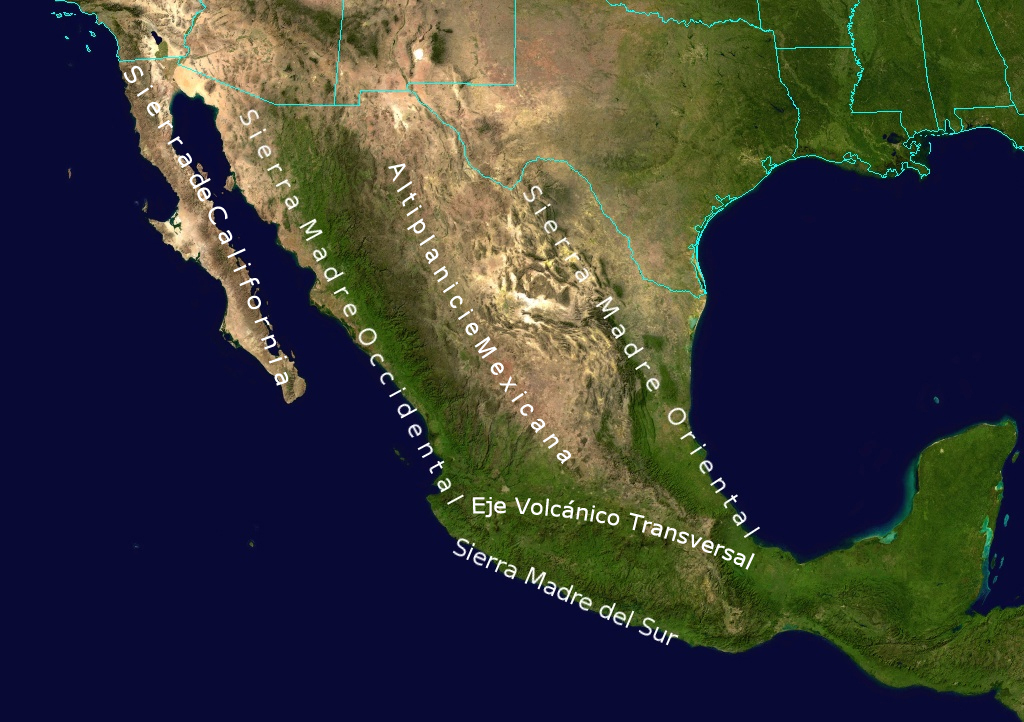
English: Topological Map labeling the most important elevations of the country |
| 日期 | |
| 来源 | NASA |
| 作者 | NASA - derivative work by Ricraider |
许可协议
| 本文件完全由NASA创作,在美国属于公有领域。根据NASA的版权方针,NASA的材料除非另有声明否则不受版权保护。(参见Template:PD-USGov/zh、NASA版权方针页面或JPL图片使用方针。) | ||
 |
警告:
|
原始上传日志
原始描述頁面位於這裡。下列使用者名稱均來自en.wikipedia。
- 2010-08-24 02:05 Ricraider 1024×722× (465741 bytes) {{Information |Description = Topological Map labeling the most important elevations of the country |Source = NASA |Date = 8-23-10 |Author = ricraider |Permission = |other_versions = }}
文件历史
点击某个日期/时间查看对应时刻的文件。
| 日期/时间 | 缩略图 | 大小 | 用户 | 备注 | |
|---|---|---|---|---|---|
| 当前 | 2012年12月21日 (五) 09:02 | | 1,024 × 722(455 KB) | Urdangaray | {{Information |Description={{en|Topological Map labeling the most important elevations of the country}} |Source=Transferred from [http://en.wikipedia.org en.wikipedia]<br/> (Original text : ''NASA'') |Date=8-23-10<br/> ({{Original upload date|2010-08-2... |
文件用途
以下5个页面使用本文件:
全域文件用途
以下其他wiki使用此文件:
- bs.wikipedia.org上的用途
- cs.wikipedia.org上的用途
- de.wikipedia.org上的用途
- en.wikipedia.org上的用途
- es.wikipedia.org上的用途
- eu.wikipedia.org上的用途
- fa.wikipedia.org上的用途
- is.wikipedia.org上的用途
- ja.wikipedia.org上的用途
- nn.wikipedia.org上的用途
- no.wikipedia.org上的用途
- pl.wikipedia.org上的用途
- simple.wikipedia.org上的用途
- sk.wikipedia.org上的用途
- sv.wikipedia.org上的用途
- tr.wikipedia.org上的用途
- uk.wikipedia.org上的用途