
File:Iowa 1718.jpg

本预览的尺寸:800 × 533像素。 其他分辨率:320 × 213像素 | 640 × 426像素 | 1,024 × 682像素 | 1,280 × 853像素 | 1,560 × 1,039像素。
原始文件 (1,560 × 1,039像素,文件大小:488 KB,MIME类型:image/jpeg)
| 描述 |
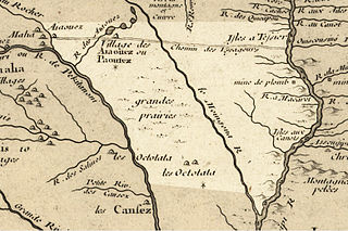
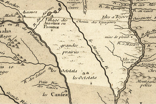
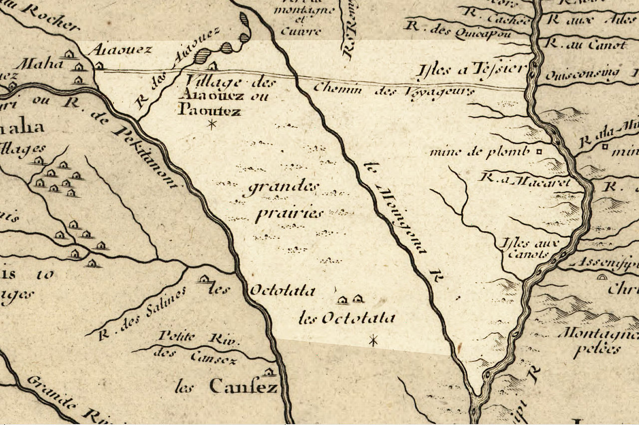
English: Iowa 1718, approximate modern state area highlighted, from Carte de la Louisiane et du cours du Mississipi by Guillaume de L'Isle. generally accepted translations: "Aiaouez"= Ioway; 'Octotata"=Otoe; "Moingona"= Des Moines River; "Macaret"= Maquoketa River; "Chemin des Voyageurs"= Main Voyageur’s Trail. "Paoutez" is probably a varaint of "Báxoje" (Ioway) which has an alternative pronounciation of [ˌpaˈxodʒɛ]. Other tribes include the "Cansez"= Kansa, and "Maha"= Omaha. |
| 日期 | (mod. 2009) |
| 来源 | Library of Congress Public Domain Site: http://hdl.loc.gov/loc.gmd/g3700.ct000666 |
| 作者 | |
| 授权 (二次使用本文件) |
US Govt Public Domain, also author +100 years |

许可协议
|
本作品在其来源国以及其他著作权期限是作者逝世后100年或以下的国家和地区属于公有领域。 | |
| 本文件已被确认为免除已知的著作权法限制(包括所有相关权利)。 | |
原始上传日志
原始描述頁面位於這裡。下列使用者名稱均來自en.wikipedia。
- 2009-02-16 20:57 Billwhittaker 1560×1039× (499934 bytes) cleaner, better res., same base map, slightly better defined Iowa.
- 2009-02-16 14:44 Billwhittaker 633×369× (145834 bytes) {{Information |Description=Iowa 1718, approximate modern state area highlighted, from ''Carte de la Louisiane et du cours du Mississipi'' by Guillaume de L'Isle. generally accepted translations: Aiaouez= Ioway; Octotata=Otoe; Moingona= Des Moines. |Sourc
文件历史
点击某个日期/时间查看对应时刻的文件。
| 日期/时间 | 缩略图 | 大小 | 用户 | 备注 | |
|---|---|---|---|---|---|
| 当前 | 2009年9月21日 (一) 19:35 | | 1,560 × 1,039(488 KB) | Jeangagnon | {{Information |Description={{en|Iowa 1718, approximate modern state area highlighted, from ''Carte de la Louisiane et du cours du Mississipi'' by en:Guillaume de L'Isle. generally accepted translations: "Aiaouez"= en:Ioway; 'Octotata"=[[:en:O |
文件用途
以下3个页面使用本文件:
全域文件用途
以下其他wiki使用此文件:
- ca.wikipedia.org上的用途
- en.wikipedia.org上的用途
- es.wikipedia.org上的用途
- fr.wikipedia.org上的用途
- fr.wiktionary.org上的用途
- gu.wikipedia.org上的用途
- it.wikipedia.org上的用途
- ja.wikipedia.org上的用途
- kn.wikipedia.org上的用途
- ko.wikipedia.org上的用途
- pt.wikipedia.org上的用途