
File:Litoral argentino.svg

此SVG文件的PNG预览的大小:257 × 600像素。 其他分辨率:103 × 240像素 | 205 × 480像素 | 329 × 768像素 | 439 × 1,024像素 | 877 × 2,048像素 | 465 × 1,085像素。
原始文件 (SVG文件,尺寸为465 × 1,085像素,文件大小:544 KB)
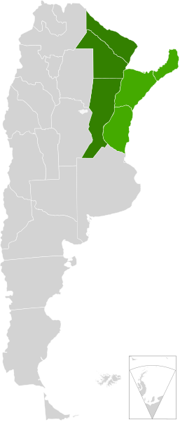
| 描述 | A map of Argentina, in scalable vector form, showing the provinces from the "Litoral argentino" |
| 日期 | (UTC) |
| 来源 | |
| 作者 |
|
| 这是一张修改过的图片,这意味着它已在原版本的基础上通过软件进行了编辑。其原始版本为:Blank Argentina Map.svg。修改者:Mahadeva。
|
我,本作品著作权人,特此采用以下许可协议发表本作品:
本文件采用知识共享署名-相同方式共享 3.0 未本地化版本许可协议授权。
- 您可以自由地:
- 共享 – 复制、发行并传播本作品
- 修改 – 改编作品
- 惟须遵守下列条件:
- 署名 – 您必须对作品进行署名,提供授权条款的链接,并说明是否对原始内容进行了更改。您可以用任何合理的方式来署名,但不得以任何方式表明许可人认可您或您的使用。
- 相同方式共享 – 如果您再混合、转换或者基于本作品进行创作,您必须以与原先许可协议相同或相兼容的许可协议分发您贡献的作品。
原始上传日志
This image is a derivative work of the following images:
- File:Blank_Argentina_Map.svg licensed with Cc-by-sa-3.0
- 2009-06-16T03:38:27Z Dexxter 465x1085 (556030 Bytes) minor corrections
- 2009-06-09T04:16:00Z Dexxter 475x1029 (571435 Bytes) size
- 2009-06-09T03:52:25Z Dexxter 475x1029 (653128 Bytes) darker background
- 2009-06-09T03:43:53Z Dexxter 475x1029 (560186 Bytes) == Summary == {{Information |Description=A blank map of Argentina in scalable vector form, including the territorials claims. |Source=Own work, based on the official cartography published by the Military Geographic Institute
Uploaded with derivativeFX
文件历史
点击某个日期/时间查看对应时刻的文件。
| 日期/时间 | 缩略图 | 大小 | 用户 | 备注 | |
|---|---|---|---|---|---|
| 当前 | 2010年8月4日 (三) 20:33 | | 465 × 1,085(544 KB) | Mahadeva | {{Information |Description=A map of Argentina, in scalable vector form, showing the provinces from the "Litoral argentino" |Source=*File:Blank_Argentina_Map.svg |Date=2010-08-04 20:32 (UTC) |Author=*File:Blank_Argentina_Map.svg: [[User:Dexxter |
文件用途
以下页面使用本文件:
全域文件用途
以下其他wiki使用此文件:
- en.wikipedia.org上的用途
- eo.wikipedia.org上的用途
- es.wikipedia.org上的用途
- fr.wikipedia.org上的用途
- ja.wikipedia.org上的用途