
File:Map of Quebec.png

本预览的尺寸:569 × 600像素。 其他分辨率:228 × 240像素 | 455 × 480像素。
原始文件 (800 × 843像素,文件大小:316 KB,MIME类型:image/png)
| 描述 |
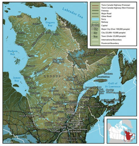
English: Map of Québec
Français : Carte du Québec |
||
| 日期 | |||
| 来源 | en:Image:Map of Quebec (English).png created by John Fowler (cartographer), who released the image to the public domain. Geospatial data from: The Atlas of Canada, The National Atlas of the United States and U.S. Geological Survey. | ||
| 作者 | John Fowler / Upload by Leslie | ||
| 授权 (二次使用本文件) |
|
||
| 其他版本 |
Français : Version française Image:Map of Quebec-fr.png
English: French version Image:Map of Quebec-fr.png |
.png)
文件历史
点击某个日期/时间查看对应时刻的文件。
| 日期/时间 | 缩略图 | 大小 | 用户 | 备注 | |
|---|---|---|---|---|---|
| 当前 | 2006年2月26日 (日) 09:22 | | 800 × 843(316 KB) | Leslie | {{PD}} Created by John Fowler, who released the image to the public domain. en:Image:Map of Quebec (English).png Category:Québec |
文件用途
以下页面使用本文件:
全域文件用途
以下其他wiki使用此文件:
- en.wikipedia.org上的用途
- et.wikipedia.org上的用途
- fi.wikipedia.org上的用途
- he.wikipedia.org上的用途
- it.wikipedia.org上的用途
- mk.wikipedia.org上的用途
- nl.wikipedia.org上的用途
- no.wikipedia.org上的用途