
File:Nicobar Islands.jpg
此为最大尺寸。
Nicobar_Islands.jpg (643 × 564像素,文件大小:70 KB,MIME类型:image/jpeg)
摘要
| 描述 |
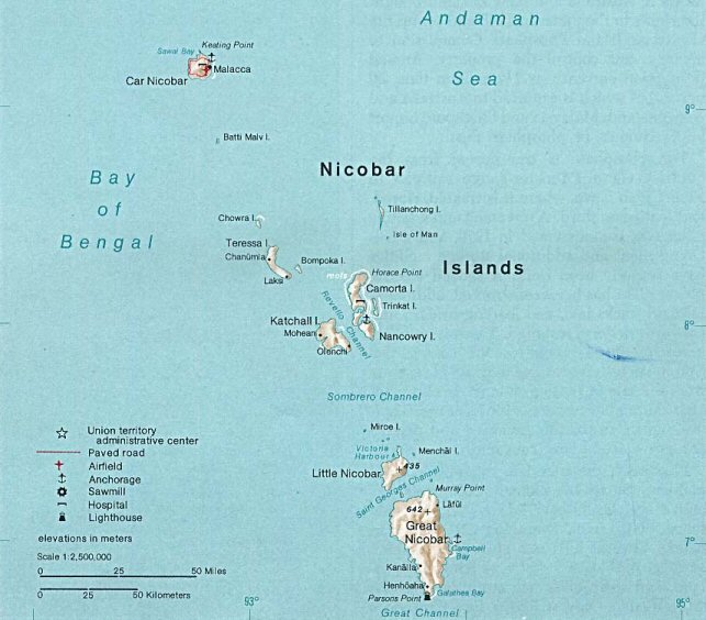
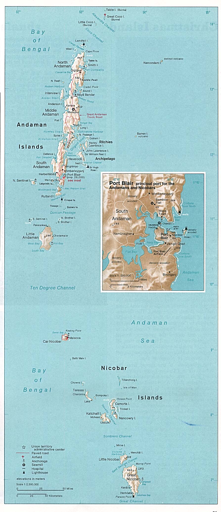
Deutsch: Karte der Inselgruppe der Nikobaren im Indischen Ozean
English: Map of the Nicobar Island in the Indian Ocean
Français : Carte d’îles Nicobar dans l’océan Indien |
| 日期 | |
| 来源 | http://www.lib.utexas.edu/maps/islands_oceans_poles/andaman_nicobar_76.jpg |
| 作者 | Taken from Perry-Castañeda Library (PCL), originally from CIA Indian Ocean Atlas |
| 其他版本 |
许可协议
| 本图像是中央情报局雇员的职务作品。作为美国联邦政府的作品,本图像或媒体属于公有领域。
|

|
文件历史
点击某个日期/时间查看对应时刻的文件。
| 日期/时间 | 缩略图 | 大小 | 用户 | 备注 | |
|---|---|---|---|---|---|
| 当前 | 2005年5月14日 (六) 22:33 | | 643 × 564(70 KB) | Jeroen | From the Indian Ocean Atlas, published by the Central Intelligence Agency, 1976. From en:Image:Nicobar_Islands.jpg ''This image is a work of a Central Intelligence Agency employee, taken or made during the course of the person's official duties. As |
文件用途
全域文件用途
以下其他wiki使用此文件:
- ace.wikipedia.org上的用途
- ar.wikipedia.org上的用途
- arz.wikipedia.org上的用途
- az.wikipedia.org上的用途
- be-tarask.wikipedia.org上的用途
- bg.wikipedia.org上的用途
- bn.wikipedia.org上的用途
- br.wikipedia.org上的用途
- ca.wikipedia.org上的用途
- ceb.wikipedia.org上的用途
- cs.wikipedia.org上的用途
- da.wikipedia.org上的用途
- de.wikipedia.org上的用途
- en.wikipedia.org上的用途
- eo.wikipedia.org上的用途
- es.wikipedia.org上的用途
- eu.wikipedia.org上的用途
- fa.wikipedia.org上的用途
- fi.wikipedia.org上的用途
- fi.wiktionary.org上的用途
- fr.wikipedia.org上的用途
- fr.wikinews.org上的用途
- gl.wikipedia.org上的用途
- gu.wikipedia.org上的用途
- hi.wikipedia.org上的用途
- id.wikipedia.org上的用途
- ilo.wikipedia.org上的用途
- it.wikipedia.org上的用途
- ja.wikipedia.org上的用途
- ka.wikipedia.org上的用途
- ko.wikipedia.org上的用途
查看本文件的更多全域用途。