
File:Noul 2015-05-10 0530Z.png
本预览的尺寸:450 × 600像素。 其他分辨率:180 × 240像素 | 360 × 480像素 | 576 × 768像素 | 768 × 1,024像素 | 1,536 × 2,048像素。
原始文件 (1,536 × 2,048像素,文件大小:4.67 MB,MIME类型:image/png)
摘要
| 描述 |
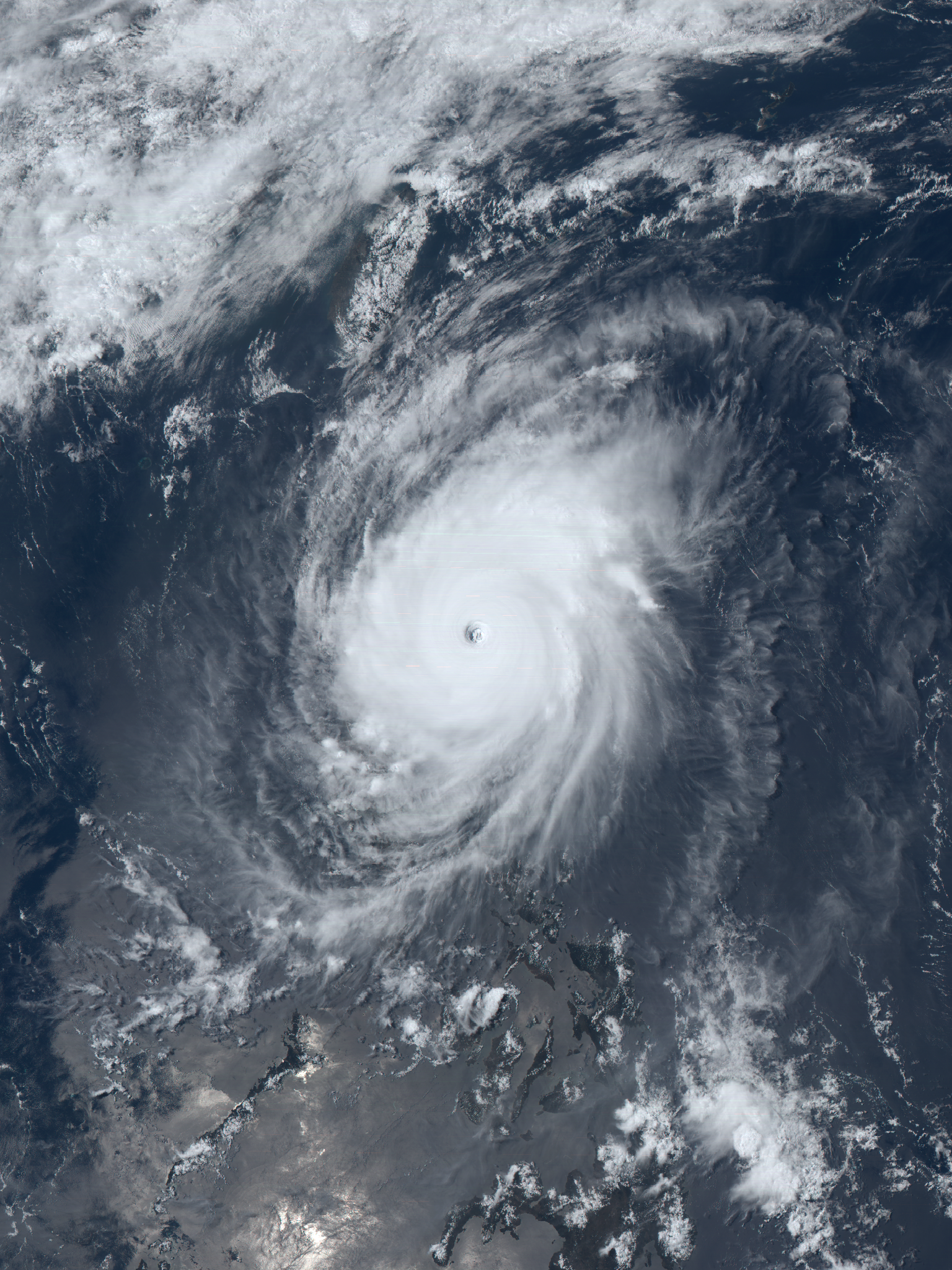
English: The Japan Meteorological Agency’s Himawari-8 satellite captured Typhoon Noul at peak intensity on May 10, 2015. This true-color picture is composited from three visible channels. |
| 日期 | |
| 来源 | RealEarth™ |
| 作者 | Himawari-8 AHI images provided by the Japan Meteorological Agency and composited by Meow |
| 相机位置 | | 在以下服务上查看本图像和附近其他图像: OpenStreetMap |
|---|
许可协议
This image was produced by the SSEC/CIMSS, University of Wisconsin–Madison. All the images published on their website can be freely used, as long as the source is acknowledged. (disclaimer (archive))
|
 |

文件历史
点击某个日期/时间查看对应时刻的文件。
| 日期/时间 | 缩略图 | 大小 | 用户 | 备注 | |
|---|---|---|---|---|---|
| 当前 | 2015年7月14日 (二) 05:02 | | 1,536 × 2,048(4.67 MB) | Meow | Reverted to version as of 14:57, 17 May 2015 |
| 2015年7月14日 (二) 05:01 |  | 1,536 × 2,048(4.93 MB) | Meow | Saturation +50% | |
| 2015年5月17日 (日) 14:57 |  | 1,536 × 2,048(4.67 MB) | Meow | Corrected the hue. | |
| 2015年5月13日 (三) 09:36 |  | 1,536 × 2,048(4.66 MB) | Meow | 10% blacker, more “NASA-like”. | |
| 2015年5月13日 (三) 05:27 |  | 1,536 × 2,048(4.47 MB) | Meow | User created page with UploadWizard |
文件用途
以下5个页面使用本文件:
全域文件用途
以下其他wiki使用此文件:
- en.wikipedia.org上的用途
- ja.wikipedia.org上的用途
- th.wikipedia.org上的用途