
File:SPSM.05.jpg

原始文件 (2,756 × 2,000像素,文件大小:3.99 MB,MIME类型:image/jpeg)
| 描述 |
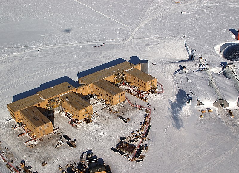
English: Buildings (Amundsen-Scott South Pole Station pictured) under construction. They have to be built on stilts at the South Pole to prevent snow buildup. The ceremonial pole and flags can be seen in the background, slightly to the left of center, below the tracks behind the buildings. The actual geographic pole is a few more metres to the left.
Flags and pole are more visible in en:Image:Amundsen-scott-south pole station 2006.jpg and en:Image:Ceremonial South Pole.jpg.
|
|||
| 日期 | ||||
| 来源 | U.S. Antarctic Program, National Science Foundation, image SPSM.05.5.JPG. | |||
| 作者 | Bill Henriksen, National Science Foundation | |||
| 授权 (二次使用本文件) |
|

原始上传日志
This image was originally uploaded at the English Wikipedia.
(All user names refer to en.wikipedia)
- 2006-03-09 16:46 Rebroad 2756×2000×8 (4188033 bytes)
文件历史
点击某个日期/时间查看对应时刻的文件。
| 日期/时间 | 缩略图 | 大小 | 用户 | 备注 | |
|---|---|---|---|---|---|
| 当前 | 2007年3月27日 (二) 22:03 | | 2,756 × 2,000(3.99 MB) | Evrik | {{Information |Description=Buildings (en:Amundsen-Scott South Pole Station pictured) have to be built on en:stilts at the en:South Pole to prevent en:snow buildup. The ceremonial pole and flags can be seen in the background, slightly t |
文件用途
以下2个页面使用本文件:
全域文件用途
以下其他wiki使用此文件:
- af.wikipedia.org上的用途
- als.wikipedia.org上的用途
- ar.wikipedia.org上的用途
- az.wikipedia.org上的用途
- ba.wikipedia.org上的用途
- be.wikipedia.org上的用途
- bg.wikipedia.org上的用途
- ca.wikipedia.org上的用途
- ceb.wikipedia.org上的用途
- cs.wikipedia.org上的用途
- cv.wikipedia.org上的用途
- cy.wikipedia.org上的用途
- da.wikipedia.org上的用途
- de.wikipedia.org上的用途
- de.wikivoyage.org上的用途
- en.wikipedia.org上的用途
- en.wikivoyage.org上的用途
- eo.wikipedia.org上的用途
- es.wikipedia.org上的用途
- et.wikipedia.org上的用途
查看本文件的更多全域用途。