
File:USDA Hardiness zone map.jpg
本预览的尺寸:601 × 599像素。 其他分辨率:241 × 240像素 | 481 × 480像素 | 770 × 768像素 | 1,027 × 1,024像素 | 2,054 × 2,048像素 | 4,014 × 4,002像素。
原始文件 (4,014 × 4,002像素,文件大小:5.92 MB,MIME类型:image/jpeg)
摘要
| 描述 |
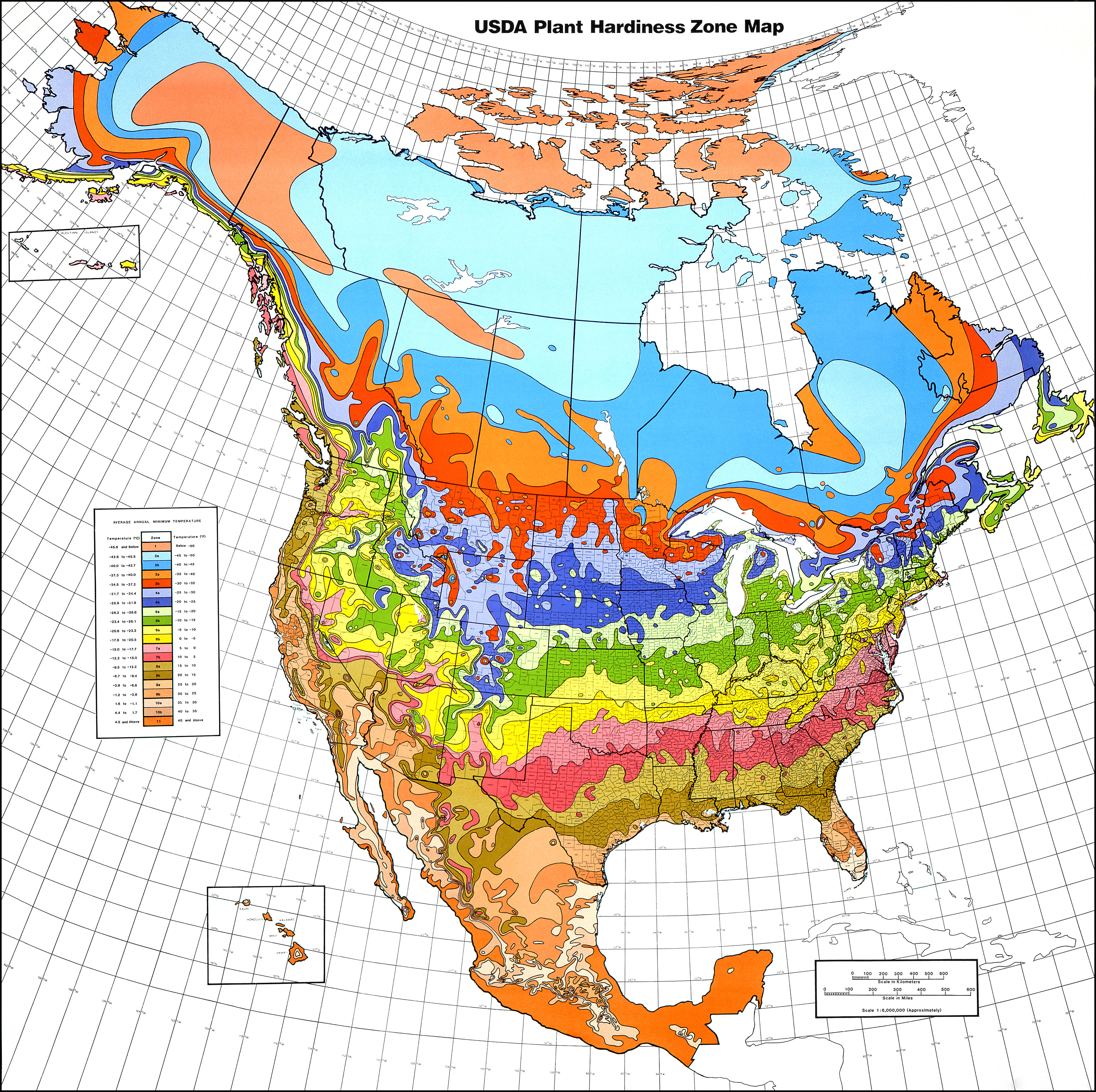
English: USDA Hardiness Zones in North America.
Albers equal area projection, standard parallels of 29.5°N and 45.5°N, scale 1 : 6,000,000 (approx.)
118×116厘米 (folded: 30×21厘米) |
| 日期 | 1990, copied 2006-12-31 |
| 来源 | USDA plant hardiness zone map 1990 (USDA Miscellaneous Publication No. 1475) ISBN: 0160187478, USDA website |
| 作者 |
Henry M. Cathey while Director, U.S. National Arboretum, Agricultural Research Service, U.S. Department of Agriculture, Washington, DC 20002
|
| 授权 (二次使用本文件) |
Public Domain |
| 其他版本 | File:USDAplanthardiness.jpg (with a bit of frame) |
许可协议
|
|
 |
文件历史
点击某个日期/时间查看对应时刻的文件。
| 日期/时间 | 缩略图 | 大小 | 用户 | 备注 | |
|---|---|---|---|---|---|
| 当前 | 2013年1月22日 (二) 00:21 | | 4,014 × 4,002(5.92 MB) | Mapmarks | printable size, ca 4000 × 4000 px download from http://planthardiness.ars.usda.gov/PHZMWeb/Images/northamerica.jpg |
| 2008年10月15日 (三) 00:49 |  | 588 × 587(238 KB) | Omegatron | perspective skew and crop - way too low resolution, though [using an external editor] | |
| 2006年12月31日 (日) 15:14 |  | 620 × 603(165 KB) | SB Johnny | {{Information |Description=USDA Hardiness Zones in the US |Source=USDA website: http://www.usna.usda.gov/Hardzone/ushzmap.html |Date=copied 2006-12-31 |Author= |Permission=Public Domain |other_versions= }} {{PD-USGov}} |
文件用途
以下页面使用本文件:
全域文件用途
以下其他wiki使用此文件:
- ca.wikipedia.org上的用途
- en.wikipedia.org上的用途
- en.wikibooks.org上的用途
- et.wikipedia.org上的用途
- fa.wikipedia.org上的用途
- fi.wikipedia.org上的用途
- fr.wikipedia.org上的用途
- he.wikipedia.org上的用途
- hu.wikipedia.org上的用途
- pl.wikipedia.org上的用途