
File:2019 Philippine measles outbreak map.png
預覽大小:384 × 599 像素。 其他解析度:154 × 240 像素 | 308 × 480 像素 | 492 × 768 像素 | 656 × 1,024 像素 | 2,000 × 3,120 像素。
原始檔案 (2,000 × 3,120 像素,檔案大小:164 KB,MIME 類型:image/png)
摘要
| 描述 |
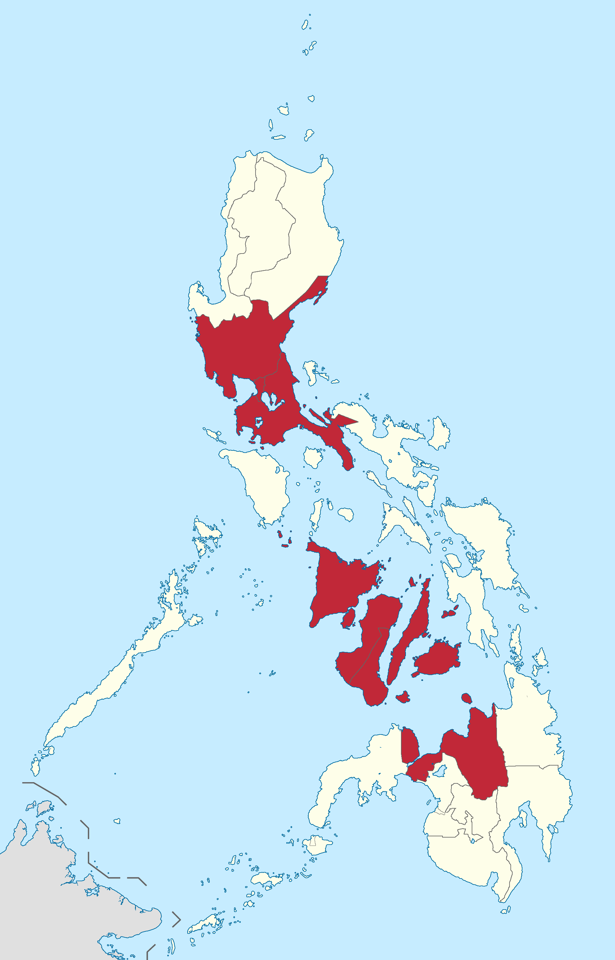
English: 2019 Philippines measles outbreak; Map displaying the regions where a measles outbreak has been officially declared by the Department of Health. |
| 日期 | |
| 來源 | Derived from Namayan's Ph fil region locator maps series. |
| 作者 |
BlankMap-Philippines.png by The Cofee
|
授權條款
此檔案採用創用CC 姓名標示-相同方式分享 3.0 未在地化版本授權條款。
- 您可以自由:
- 分享 – 複製、發佈和傳播本作品
- 重新修改 – 創作演繹作品
- 惟需遵照下列條件:
- 姓名標示 – 您必須指名出正確的製作者,和提供授權條款的連結,以及表示是否有對內容上做出變更。您可以用任何合理的方式來行動,但不得以任何方式表明授權條款是對您許可或是由您所使用。
- 相同方式分享 – 如果您利用本素材進行再混合、轉換或創作,您必須基於如同原先的相同或兼容的條款,來分布您的貢獻成品。
檔案歷史
點選日期/時間以檢視該時間的檔案版本。
| 日期/時間 | 縮圖 | 尺寸 | 使用者 | 備註 | |
|---|---|---|---|---|---|
| 目前 | 2019年2月25日 (一) 07:31 | | 2,000 × 3,120(164 KB) | Hariboneagle927 | update |
| 2019年2月20日 (三) 15:17 |  | 2,000 × 3,120(163 KB) | Hariboneagle927 | Reverted to version as of 05:30, 11 February 2019 (UTC) Even the DOH contradicts themselves regarding this. Following WHO cite on the relevant article. | |
| 2019年2月11日 (一) 05:54 |  | 2,000 × 3,120(163 KB) | Hariboneagle927 | Correction the DOH website says Eastern Visayas and not Western. | |
| 2019年2月11日 (一) 05:30 |  | 2,000 × 3,120(163 KB) | Hariboneagle927 | User created page with UploadWizard |
檔案用途
下列2個頁面有用到此檔案:
全域檔案使用狀況
以下其他 wiki 使用了這個檔案:
- en.wikipedia.org 的使用狀況
- tl.wikipedia.org 的使用狀況