
File:Ain-Diab.svg

此 SVG 檔案的 PNG 預覽的大小:800 × 502 像素。 其他解析度:320 × 201 像素 | 640 × 402 像素 | 1,024 × 643 像素 | 1,280 × 803 像素 | 2,560 × 1,606 像素 | 1,404 × 881 像素。
原始檔案 (SVG 檔案,表面大小:1,404 × 881 像素,檔案大小:26 KB)
摘要
| 描述 |
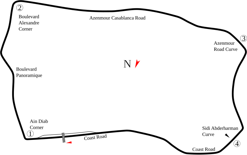
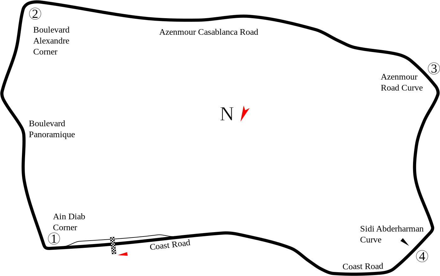
English: Track map of Ain-Diab Circuit based on modern imagery. Because the imagery was current rather than from 50 years ago, there may be some inaccuracies. Also, the location of Pit Road was uncertain. The existing image (below) showed it in a place that currently is just empty ground. Other than that, all that could be done is guess. |
| 日期 | |
| 來源 | 自己的作品 |
| 作者 | Will Pittenger |
| 其他版本 |
|

| 拍攝地點 | | 位於此地的本圖片與其他圖片: OpenStreetMap |
|---|
授權條款
我,本作品的著作權持有者,決定用以下授權條款發佈本作品:
此檔案採用共享創意 姓名標示-相同方式分享 3.0 未在地化版本授權條款。
- 您可以自由:
- 分享 – 複製、發佈和傳播本作品
- 重新修改 – 創作演繹作品
- 惟需遵照下列條件:
- 姓名標示 – 您必須指名出正確的製作者,和提供授權條款的連結,以及表示是否有對內容上做出變更。您可以用任何合理的方式來行動,但不得以任何方式表明授權條款是對您許可或是由您所使用。
- 相同方式分享 – 如果您利用本素材進行再混合、轉換或創作,您必須基於如同原先的相同或兼容的條款,來分布您的貢獻成品。
檔案歷史
點選日期/時間以檢視該時間的檔案版本。
| 日期/時間 | 縮圖 | 尺寸 | 用戶 | 備註 | |
|---|---|---|---|---|---|
| 目前 | 2008年7月29日 (二) 05:51 | | 1,404 × 881(26 KB) | Will Pittenger | {{Information |Description={{en|1=Track map of w:Ain-Diab Circuit based on modern imagery. Because the imagery was current rather than from 50 years ago, there may be some inaccuracies. Also, the location of Pit Road was uncertain. The existing im |
檔案用途
下列3個頁面有用到此檔案:
全域檔案使用狀況
以下其他 wiki 使用了這個檔案:
- ar.wikipedia.org 的使用狀況
- ast.wikipedia.org 的使用狀況
- bg.wikipedia.org 的使用狀況
- bn.wikipedia.org 的使用狀況
- bs.wikipedia.org 的使用狀況
- ca.wikipedia.org 的使用狀況
- cs.wikipedia.org 的使用狀況
- de.wikipedia.org 的使用狀況
- en.wikipedia.org 的使用狀況
- eo.wikipedia.org 的使用狀況
- es.wikipedia.org 的使用狀況
- et.wikipedia.org 的使用狀況
- eu.wikipedia.org 的使用狀況
- fa.wikipedia.org 的使用狀況
- fi.wikipedia.org 的使用狀況
- fr.wikipedia.org 的使用狀況
- gl.wikipedia.org 的使用狀況
- hr.wikipedia.org 的使用狀況
- hu.wikipedia.org 的使用狀況
- id.wikipedia.org 的使用狀況
- it.wikipedia.org 的使用狀況
- ja.wikipedia.org 的使用狀況
- ko.wikipedia.org 的使用狀況
- lv.wikipedia.org 的使用狀況
- mr.wikipedia.org 的使用狀況
- ms.wikipedia.org 的使用狀況
- nl.wikipedia.org 的使用狀況
- no.wikipedia.org 的使用狀況
檢視此檔案的更多全域使用狀況。