
File:Satellite image of Thomas Fire.jpg

預覽大小:548 × 600 像素。 其他解析度:219 × 240 像素 | 439 × 480 像素 | 702 × 768 像素 | 936 × 1,024 像素 | 1,872 × 2,048 像素 | 3,456 × 3,781 像素。
原始檔案 (3,456 × 3,781 像素,檔案大小:1.88 MB,MIME 類型:image/jpeg)
摘要
| 描述 |
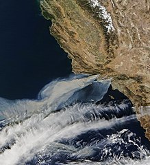
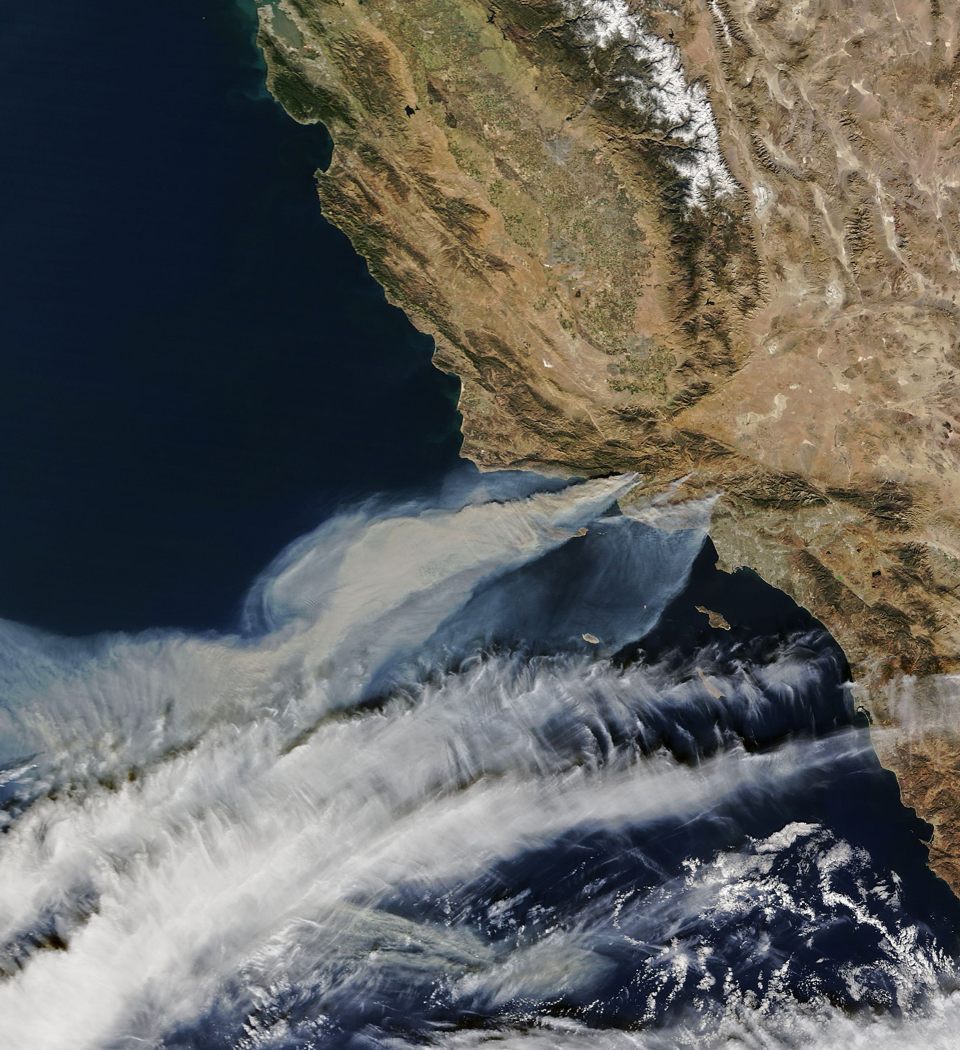
English: Satellite image from the Terra satellite of the smoke from the Thomas Fire in Ventura County, on December 5, along with the smoke from 2 other smaller fires, in Southern California. |
| 日期 | 攝於2017年十二月5日, 10:52:11 |
| 來源 | https://earthobservatory.nasa.gov/NaturalHazards/view.php?id=91379 |
| 作者 |
NASA Earth Observatory images by Joshua Stevens, using MODIS data. Instrument(s): Terra - MODIS |
| 授權許可 (重用此檔案) |
NASA |
授權條款
| 本作品由NASA創作,屬於公有領域。根據NASA的版權政策:“NASA的創作除非另有聲明否則不受版權保護。”(參見:Template:PD-USGov/zh,NASA版權政策或JPL圖像使用政策) | ||
 |
警告:
|
檔案歷史
點選日期/時間以檢視該時間的檔案版本。
| 日期/時間 | 縮圖 | 尺寸 | 用戶 | 備註 | |
|---|---|---|---|---|---|
| 目前 | 2017年12月6日 (三) 07:15 | | 3,456 × 3,781(1.88 MB) | FriarTuck1981 | Reverted to version as of 07:13, 6 December 2017 (UTC) |
| 2017年12月6日 (三) 07:14 |  | 4,879 × 5,338(2.3 MB) | FriarTuck1981 | Reverted to version as of 07:11, 6 December 2017 (UTC) | |
| 2017年12月6日 (三) 07:13 |  | 3,456 × 3,781(1.88 MB) | FriarTuck1981 | cropped photo | |
| 2017年12月6日 (三) 07:11 |  | 4,879 × 5,338(2.3 MB) | FriarTuck1981 | User created page with UploadWizard |
檔案用途
下列2個頁面有用到此檔案:
全域檔案使用狀況
以下其他 wiki 使用了這個檔案:
- ar.wikipedia.org 的使用狀況
- cs.wikipedia.org 的使用狀況
- en.wikipedia.org 的使用狀況
- es.wikinews.org 的使用狀況
- fa.wikipedia.org 的使用狀況
- ms.wikipedia.org 的使用狀況
- vi.wikipedia.org 的使用狀況
- www.wikidata.org 的使用狀況