
File:Taiwan location map.svg

此 SVG 檔案的 PNG 預覽的大小:499 × 600 像素。 其他解析度:200 × 240 像素 | 399 × 480 像素 | 639 × 768 像素 | 852 × 1,024 像素 | 1,704 × 2,048 像素 | 1,016 × 1,221 像素。
原始檔案 (SVG 檔案,表面大小:1,016 × 1,221 像素,檔案大小:121 KB)

|
這張圖片需要更新。在這樣做的時候,您可以為該圖片加入時間戳。
|

|
The boundaries on this map show the de facto situation. This is just one of several different views on the subject (see COM:NPOV). |
摘要
| 描述 |
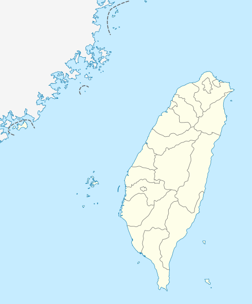
Quadratische Plattkarte, N-S-Streckung 110 %. Geographische Begrenzung der Karte:
Equirectangular projection, N/S stretching 110 %. Geographic limits of the map:
|
| 日期 | |
| 來源 | own work, using United States National Imagery and Mapping Agency data |
| 作者 | NordNordWest |

|
|
授權條款
我,本作品的著作權持有者,決定用以下授權條款發佈本作品:

|
已授權您依據自由軟體基金會發行的無固定段落、封面文字和封底文字GNU自由文件授權條款1.2版或任意後續版本,對本檔進行複製、傳播和/或修改。該協議的副本列在GNU自由文件授權條款中。 |
此檔案採用共享創意 姓名標示-相同方式分享 3.0 未在地化版本授權條款。
- 您可以自由:
- 分享 – 複製、發佈和傳播本作品
- 重新修改 – 創作演繹作品
- 惟需遵照下列條件:
- 姓名標示 – 您必須指名出正確的製作者,和提供授權條款的連結,以及表示是否有對內容上做出變更。您可以用任何合理的方式來行動,但不得以任何方式表明授權條款是對您許可或是由您所使用。
- 相同方式分享 – 如果您利用本素材進行再混合、轉換或創作,您必須基於如同原先的相同或兼容的條款,來分布您的貢獻成品。
您可以選擇您需要的授權條款。
檔案歷史
點選日期/時間以檢視該時間的檔案版本。
| 日期/時間 | 縮圖 | 尺寸 | 用戶 | 備註 | |
|---|---|---|---|---|---|
| 目前 | 2011年8月22日 (一) 11:15 | | 1,016 × 1,221(121 KB) | NordNordWest | minor corrections |
| 2011年7月19日 (二) 11:54 |  | 1,016 × 1,222(166 KB) | Bencmq | Reverted to the version before dispute | |
| 2011年7月19日 (二) 09:46 |  | 1,016 × 1,222(156 KB) | JOSH tw | You did not answer my query. If you would like to use this file on global website of wiki commons, you have to consider different concepts in order to keep it neutral | |
| 2011年7月19日 (二) 07:24 |  | 1,016 × 1,221(121 KB) | NordNordWest | You can upload a new file if you want to, but don't change the status that is shown here. Next revert -> COM:V | |
| 2011年7月19日 (二) 04:20 |  | 1,016 × 1,222(156 KB) | JOSH tw | If Kosovo as an UN unreconignized state can be shown on distinct appearance with Serbia, there is unreasonable to treat each other differently... especially P.R.China has never ruled Taiwan at any period of history | |
| 2011年7月18日 (一) 21:59 |  | 1,016 × 1,221(121 KB) | NordNordWest | please don't change the political status shown in this map | |
| 2011年7月18日 (一) 20:23 |  | 1,016 × 1,222(156 KB) | JOSH tw | Fixed map, political divisions have changed | |
| 2011年6月3日 (五) 16:54 |  | 1,016 × 1,221(127 KB) | NordNordWest | please don't change the political status shown in this map | |
| 2011年6月3日 (五) 13:19 |  | 1,016 × 1,222(156 KB) | Energiya | Fix the border of Matsu(Dongyin) and Kinmen (Dadan, Erdan, Wuqiu) see the page of Matsu Island and Kinmen. | |
| 2010年12月28日 (二) 17:19 |  | 1,016 × 1,222(166 KB) | NordNordWest | wrong upd |
檔案用途
超過 100 個頁面有用到此檔案。 下列清單只列出前 100 筆有用到此檔案的頁面。 您也可以檢視完整清單。
- 2004年國際足協室內五人足球世界錦標賽
- 921大地震
- 一府二鹿三艋舺
- 七美機場
- 世界宗教博物館
- 东引岛
- 东碇岛
- 中華民國國慶煙火
- 中華民國臺灣地區島嶼列表
- 中華民國臺灣地區燈塔列表
- 中華職業棒球大聯盟
- 亞洲足球俱樂部列表
- 內洞國家森林遊樂區
- 北竿鄉
- 南竿鄉
- 台江國家公園
- 台灣棒球史
- 台灣海峽飛彈危機
- 台灣百岳
- 吉貝嶼
- 和平島
- 員貝嶼
- 嘉義市私立興華高級中學
- 嘉義機場
- 國立故宮博物院南部院區
- 國立海洋科技博物館
- 基隆嶼
- 外傘頂洲
- 屏東機場
- 岡山路竹延伸線
- 已不存在国家列表
- 忠孝橋
- 恆春機場
- 成功嶺
- 拉魯島
- 新北市立十三行博物館
- 新北市立鶯歌陶瓷博物館
- 新北市立黃金博物館
- 新竹市立玻璃工藝博物館
- 新竹機場
- 望安機場
- 東引機場
- 東眼山國家森林遊樂區
- 棉花嶼
- 樹火紀念紙博物館
- 海坛岛
- 滿月圓國家森林遊樂區
- 濁水溪
- 猛虎嶼
- 獅嶼
- 第三波高速公路
- 綠島機場
- 臺中水湳機場
- 臺中清泉崗機場
- 臺北松山機場
- 臺南機場
- 臺東機場
- 臺灣世界遺產潛力點
- 臺灣捷運系統
- 臺灣桃園國際機場
- 臺灣機場列表
- 臺灣水庫
- 臺灣湖泊列表
- 臺灣燈會
- 臺鐵捷運化
- 花瓶嶼
- 花蓮機場
- 蘭嶼機場
- 虎井嶼
- 觀霧國家森林遊樂區
- 金門機場
- 關子嶺溫泉
- 颱風啟德 (2000年)
- 颱風敏督利 (2004年)
- 颱風格美 (2006年)
- 颱風桃芝 (2001年)
- 颱風波密拉 (1961年)
- 颱風泰利 (2005年)
- 颱風海棠 (2005年)
- 颱風海鷗 (2008年)
- 颱風瑪姬
- 颱風碧利斯 (2000年)
- 颱風耐特 (1991年)
- 颱風艾利 (2004年)
- 颱風荷貝 (1979年)
- 颱風薇拉 (1977年)
- 颱風象神 (2000年)
- 颱風賀伯
- 颱風賽洛瑪 (1977年)
- 颱風辛樂克 (2008年)
- 颱風韋恩 (1986年)
- 颱風龍王 (2005年)
- 馬祖北竿機場
- 馬祖南竿機場
- 高登島
- 高鐵橋下雲林段道路
- 高雄國際機場
- 高雄市電影館
- 高雄捷運黃線
- 鳥嶼
檢視連結到這個檔案的更多連結。
全域檔案使用狀況
以下其他 wiki 使用了這個檔案:
- af.wikipedia.org 的使用狀況
- an.wikipedia.org 的使用狀況
- ar.wikipedia.org 的使用狀況
- ast.wikipedia.org 的使用狀況
- Taiwán
- Taipei 101
- Taipéi
- Nuevu Taipéi
- Keelung
- Taoyuan
- Taichung
- Muséu Nacional del Palaciu
- Islles Pescadores
- Módulu:Mapa de llocalización/datos/República de China
- Módulu:Mapa de llocalización/datos/Taiwán
- Módulu:Mapa de llocalización/datos/República de China/usu
- Aeropuertu Internacional de Taiwán Taoyuan
- Puertu de Kaohsiung
- Puertu de Taipéi
- az.wikipedia.org 的使用狀況
- ba.wikipedia.org 的使用狀況
- bcl.wikipedia.org 的使用狀況
- be.wikipedia.org 的使用狀況
- bg.wikipedia.org 的使用狀況
- bn.wikipedia.org 的使用狀況
- bs.wikipedia.org 的使用狀況
- ceb.wikipedia.org 的使用狀況
檢視此檔案的更多全域使用狀況。