
File:Map of the Armenian highland and Caucasus mountains 12 122846.jpg
預覽大小:757 × 599 像素。 其他解析度:303 × 240 像素 | 606 × 480 像素 | 970 × 768 像素 | 1,280 × 1,013 像素 | 2,400 × 1,900 像素。
原始檔案 (2,400 × 1,900 像素,檔案大小:1.94 MB,MIME 類型:image/jpeg)
摘要
| 描述 |
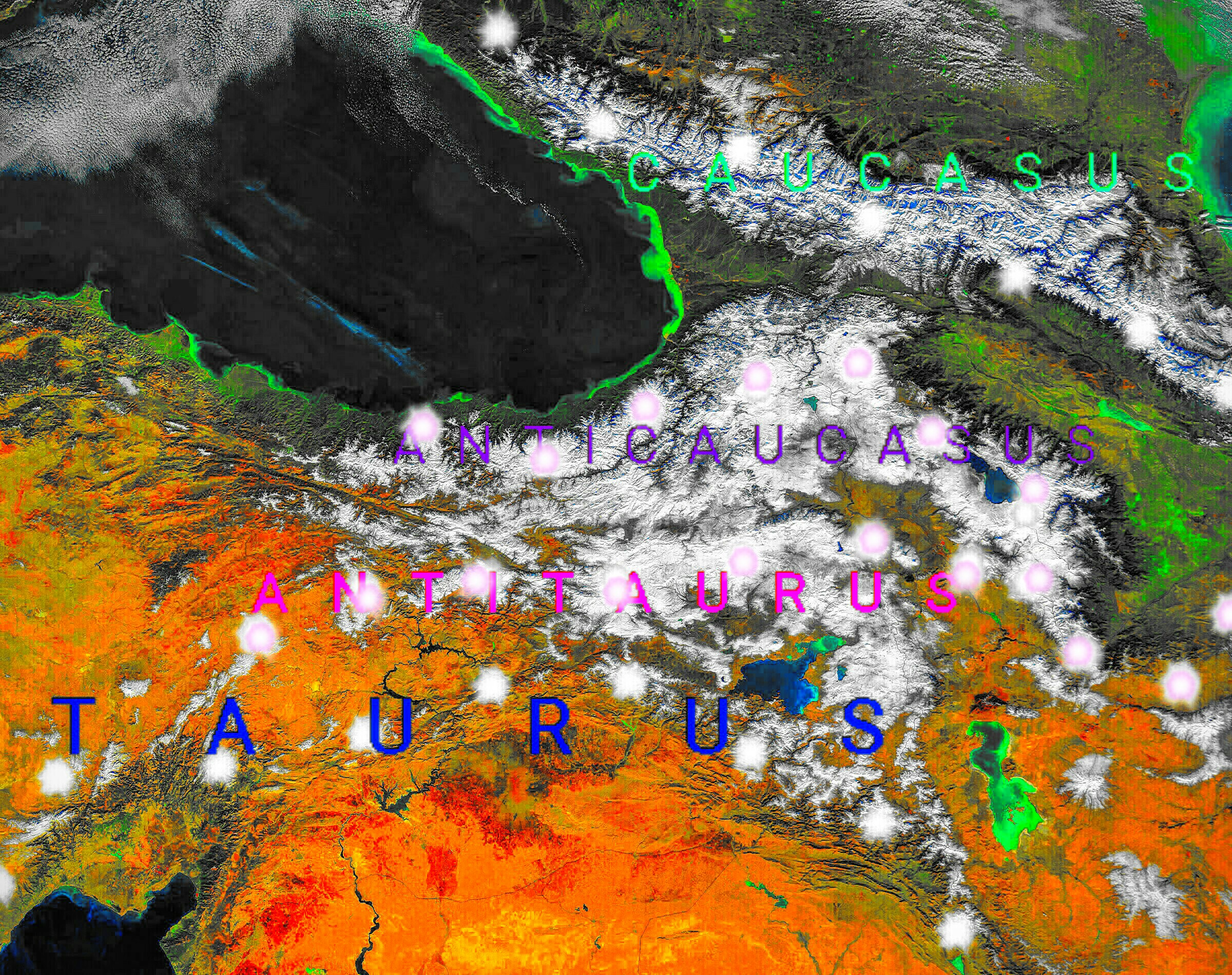
English: NASA's space satellite photo image of the Armenian highland and Caucasus mountains, which turned into map with descriptions of the geographical areas of this region. |
| 日期 | |
| 來源 | 個人作品,使用: Monts du Caucase.jpg |
| 作者 | Казбек Эльбрусович |
NASA's space satellite photo image of the Armenian highland and Caucasus mountains, which turned into map with descriptions of the geographical areas of this region.
授權條款
| 本作品由NASA創作,屬於公有領域。根據NASA的版權政策:“NASA的創作除非另有聲明否則不受版權保護。”(參見:Template:PD-USGov/zh,NASA版權政策或JPL圖像使用政策) | ||
 |
警告:
|
檔案歷史
點選日期/時間以檢視該時間的檔案版本。
| 日期/時間 | 縮圖 | 尺寸 | 用戶 | 備註 | |
|---|---|---|---|---|---|
| 目前 | 2018年4月14日 (六) 01:39 | | 2,400 × 1,900(1.94 MB) | Казбек Эльбрусович | Cross-wiki upload from ru.wikipedia.org |
檔案用途
下列頁面有用到此檔案:
全域檔案使用狀況
以下其他 wiki 使用了這個檔案:
- en.wikipedia.org 的使用狀況
- es.wikipedia.org 的使用狀況
- fa.wikipedia.org 的使用狀況
- fr.wikipedia.org 的使用狀況
- it.wikipedia.org 的使用狀況
- ru.wikipedia.org 的使用狀況