
File:Mississippi River map.png

預覽大小:800 × 502 像素。 其他解析度:320 × 201 像素 | 640 × 402 像素 | 1,024 × 643 像素 | 1,386 × 870 像素。
原始檔案 (1,386 × 870 像素,檔案大小:47 KB,MIME 類型:image/png)
FRom en Wiki by Bluelion. Cite from en wiki:
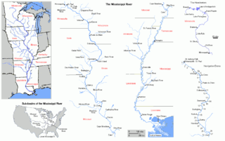
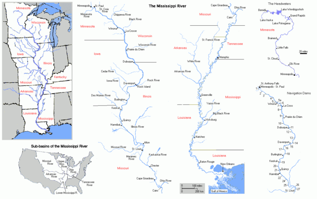
Map of Mississippi River. I made this map myself and reserve no rights to it. The maps were made by extensively modifying copyright-free maps generated by U.S. Government on-line mapping utilites, either the Department of the Interior's National Atlas of the United States Interactive Map Browser archive copy at the Wayback Machine, or the U.S. Census Bureau's old TIGER Map Browser.
| 我,此作品的版權所有人,釋出此作品至公共領域。此授權條款在全世界均適用。 這可能在某些國家不合法,如果是的話: 我授予任何人有權利使用此作品於任何用途,除受法律約束外,不受任何限制。 |
檔案歷史
點選日期/時間以檢視該時間的檔案版本。
| 日期/時間 | 縮圖 | 尺寸 | 用戶 | 備註 | |
|---|---|---|---|---|---|
| 目前 | 2005年6月27日 (一) 19:10 | | 1,386 × 870(47 KB) | Jan Kronsell | FRom en Wiki by Bluelion. Cite from en wiki: Map of '''''Mississippi River'''''. I made this map myself and '''reserve no rights''' to it. The maps were made by extensively modifying '''copyright-free''' maps generated by U.S. Government on-line mapping |
檔案用途
下列頁面有用到此檔案:
全域檔案使用狀況
以下其他 wiki 使用了這個檔案:
- am.wikipedia.org 的使用狀況
- an.wikipedia.org 的使用狀況
- bn.wikipedia.org 的使用狀況
- br.wikipedia.org 的使用狀況
- cv.wikipedia.org 的使用狀況
- cy.wikipedia.org 的使用狀況
- da.wikipedia.org 的使用狀況
- eo.wikipedia.org 的使用狀況
- gl.wikipedia.org 的使用狀況
- it.wikipedia.org 的使用狀況
- la.wikipedia.org 的使用狀況
- ml.wikipedia.org 的使用狀況
- ms.wikipedia.org 的使用狀況
- no.wikipedia.org 的使用狀況
- pt.wikipedia.org 的使用狀況
- qu.wikipedia.org 的使用狀況
- roa-tara.wikipedia.org 的使用狀況
- scn.wikipedia.org 的使用狀況
- sl.wikipedia.org 的使用狀況
- sv.wikipedia.org 的使用狀況
- ta.wikipedia.org 的使用狀況
- te.wikipedia.org 的使用狀況
- war.wikipedia.org 的使用狀況