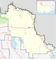
File:Australia Victoria Swan Hill Rural City location map.svg
外观

此SVG文件的PNG预览的大小:535 × 561像素。 其他分辨率:229 × 240像素 | 458 × 480像素 | 732 × 768像素 | 977 × 1,024像素 | 1,953 × 2,048像素。
原始文件 (SVG文件,尺寸为535 × 561像素,文件大小:580 KB)
文件历史
点击某个日期/时间查看对应时刻的文件。
| 日期/时间 | 缩略图 | 大小 | 用户 | 备注 | |
|---|---|---|---|---|---|
| 当前 | 2011年2月18日 (五) 14:45 |  | 535 × 561(580 KB) | Cassowary | {{Information |Description ={{en|1=Blank map of w:Swan Hill Rural City, Victoria, Australia, with the following information shown: * LGA boundaries * Coastline, lakes and rivers * Highways and freeways * Urban areas * Parks Geographic limits: * No |
文件用途
以下3个页面使用本文件:
全域文件用途
以下其他wiki使用此文件:
- ar.wikipedia.org上的用途
- ceb.wikipedia.org上的用途
- en.wikipedia.org上的用途
- Rural City of Swan Hill
- Boundary Bend, Victoria
- Robinvale
- Nyah West
- Manangatang
- Swan Hill
- Ultima, Victoria
- Woorinen South
- Lake Boga, Victoria
- Annuello, Victoria
- Bannerton, Victoria
- Beverford, Victoria
- Piangil
- Nyah, Victoria
- Wemen, Victoria
- Kooloonong
- Fish Point, Victoria
- Vinifera, Victoria
- Tol Tol
- Castle Donnington, Victoria
- Winnamboo
- Meatian
- Speewa, Victoria
- Liparoo
- Cocamba
- Waitchie
- Gowanford
- Chinkapook
- Gerahmin
- Chillingollah, Victoria
- Nowie, Victoria
- Murnungin
- Bolton, Victoria
- Kunat
- Pira, Victoria
- Chinangin
- Lake Powell, Victoria
- Natya, Victoria
- Tresco, Victoria
- Wandown
- Nyrraby
- Goschen, Victoria
- Template:Towns in the Rural City of Swan Hill
- Tyntynder
- Pental Island
- Module:Location map/data/Australia Victoria Rural City of Swan Hill/doc
- Happy Valley, Victoria
- Narrung, Victoria
查看此文件的更多全域用途。


