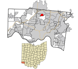
格林希爾
| 格林希爾 | |
|---|---|
| 村 | |
 | |
 | |
| 坐標:39°16′07″N 84°31′02″W / 39.2686°N 84.5172°W | |
| 國家 | 美國 |
| 州 | 俄亥俄州 |
| 縣 | 漢密爾頓縣 |
| 面積[1] | |
| • 總計 | 1.25 平方英里(3.24 平方公里) |
| • 陸地 | 1.25 平方英里(3.24 平方公里) |
| • 水域 | 0 平方英里(0 平方公里) |
| 海拔[2] | 804 英尺(245 公尺) |
| 人口(2010年美國人口普查) | |
| • 總計 | 3,615人 |
| • 估計(2012[3]) | 3,596 |
| • 密度 | 2,892.0人/平方英里(1,116.6人/平方公里) |
格林希爾(Greenhills)是美國俄亥俄州漢密爾頓縣的一個村,位於39°16′7″N 84°31′2″W / 39.26861°N 84.51722°W[4] ,面積1.25平方英里(3.24平方公里)[1],人口3,615人(2010年美國人口普查)[5]。
格林希爾是美國聯邦政府在20世紀30年代大蕭條期間規劃建造的三個「綠帶社區」之一(另外兩個是馬利蘭州的綠帶城和威斯康星州的格林代爾[6][7][8]),國際風格的聯排別墅周圍,被林帶和自然景觀環繞。original International-style townhomes.格林希爾歷史區以及村公所被列入國家史跡名錄。[9][10][11]
參考[編輯]
- ^ 1.0 1.1 US Gazetteer files 2010. 美國人口普查局. [2013-01-06]. (原始內容存檔於2012-07-14).
- ^ US Board on Geographic Names. United States Geological Survey. 2007-10-25 [2008-01-31]. (原始內容存檔於2012-02-04).
- ^ Population Estimates. 美國人口普查局. [2013-06-17]. (原始內容存檔於2013-06-17).
- ^ US Gazetteer files: 2010, 2000, and 1990. 美國人口普查局. 2011-02-12 [2011-04-23]. (原始內容存檔於2011-01-02).
- ^ Profile of General Population and Housing Characteristics: 2010 Demographic Profile Data (DP-1): Greenhills village, Ohio. U.S. Census Bureau, American Factfinder. [2012-11-01]. (原始內容存檔於2013-09-11).
- ^ Halpern, Sue, New Deal City, Mother Jones, May–June 2002 [2007-07-07], (原始內容存檔於2021-02-24)
- ^ Greendale Originals - The shops, history and events in the Village of Greendale, Wisconsin.. (原始內容存檔於2012-02-07).
- ^ 存档副本. [2017-01-28]. (原始內容存檔於2016-12-30).
- ^ "New Deal Towns In Danger", New York Times (February 9, 2009). [2017-01-28]. (原始內容存檔於2021-02-27).
- ^ National Register Information System. National Register of Historic Places. National Park Service. 2009-03-13.
- ^ Village of Greenhills, Ohio (頁面存檔備份,存於互聯網檔案館), Village of Greenhills, n.d. Accessed 2009-11-17.
