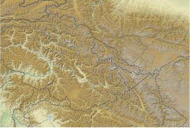
喀喇崑崙山口
| 喀喇崑崙山口 | |
|---|---|
| 海拔 | 5,540米(18,180英尺) |
| 位置 | |
| 山脈 | 喀喇崑崙山脈 |
| 坐標 | 35°30′48″N 77°49′23″E / 35.51333°N 77.82306°E座標:35°30′48″N 77°49′23″E / 35.51333°N 77.82306°E |
喀喇崑崙山口是位於喀喇崑崙山脈的一座山口,海拔5,540米或18,176英尺[1],在中國和印度的邊界上。[2]歷史上是來往塔里木盆地莎車與拉達克列城之間商路中最高的一座山口。喀喇崑崙在突厥語中意為黑色卵石。[3]
由於高海拔和補給缺乏,路邊幾乎沒有植被,[4]歷史上路過該地的商隊牲畜的死亡致使路途白骨遍野,成為該山口最令人印象深刻的特點之一。[5]上從北面到山口,首先沿古代塔里木盆地到西藏的桑珠古道上行。途中翻越海拔5364米的桑株達坂,沿喀拉喀什河谷到今新藏公路上的賽圖拉鎮。在此與去西藏的路分叉,向南通過比較容易的Suget Pass (36°09′33″N 78°00′32″E / 36.15917°N 78.00889°E),最後達到喀喇崑崙山口。[6]而從南面到山口前要穿越海拔5300米的達普桑盆地,約需3天時間。[7]:216
喀喇崑崙山口夾在兩山山巒之間,約45米寬。因為常年強風無冰雪覆蓋。氣溫很低,暴風雪頻繁,但儘管如此喀喇崑崙山口仍然被認為是相對容易通過的,因為兩邊地勢均是緩慢升高,且無冰雪封山,一年中大部分時間可通過。[7]:28現在,這段中印邊界是關閉的。中國一側從新藏公路到山口下的神仙灣哨所修有公路。
邊界問題[編輯]
喀喇崑崙山口在中國新疆和印控克什米爾的邊界上,其正西邊正是印巴爭議的錫亞琴冰川。1963年中國和巴基斯坦的邊界協定提到邊界終於喀喇崑崙山口,因此該地是一個潛在的三國邊界交點。但印度不承認該協定,也不承認其中規定的喀喇崑崙走廊歸屬中國的條款,[8]而且自1984年後錫亞琴冰川由印度控制。目前事實上的三邊交界點則在此地以西100公里的因地拉科山口。
參見[編輯]
參考資料[編輯]
- ^ SRTM data; the figure is now known to be a few meters lower than the figure of 5578 provided in Rizvi, Janet. Trans-Himalayan Caravans : Merchant Princes and Peasant Traders in Ladakh, p. 28. 1999. Oxford University Press. New Delhi. ISBN 0-19-564855-2.
- ^ Pass to better relations with China. India: The Hindu. 2013 [7 July 2013]. (原始內容存檔於2013-04-29).
- ^ Younghusband, Francis E. The Heart of a Continent: A Narrative of Travels in Manchuria, across the Gobi Desert, through the Himalayas, the Pamirs and Chitral, 1884-94. First published: 1897. London. Unabridged facsimile (2005): Elibron Classics Replica Edition, p. 225. London ISBN 1-4212-6551-6 (pbk); ISBN 1-4212-6550-8 (hbk).
- ^ Rizvi, Janet. Ladakh: Crossroads of High Asia, p. 48. 1983. Oxford University Press. Reprint: Oxford University Press, New Delhi (1996). ISBN 0-19-564546-4.
- ^ Shaw, Robert. (1871). Visits to High Tartary, Yarkand and Kashgar. Reprint with Introduction by Peter Hopkirk (1984): Oxford University Press, p. 431. ISBN 0-19-583830-0.
- ^ Younghusband, Francis E. The Heart of a Continent: A Narrative of Travels in Manchuria, across the Gobi Desert, through the Himalayas, the Pamirs and Chitral, 1884-94. First published: 1897. London. Unabridged facsimile (2005): Elibron Classics Replica Edition, p. 226. London ISBN 1-4212-6551-6 (pbk); ISBN 1-4212-6550-8 (hbk).
- ^ 7.0 7.1 Rizvi, Janet. (1999). Trans-Himalayan Caravans : Merchant Princes and Peasant Traders in Ladakh. Oxford University Press. New Delhi. ISBN 0-19-564855-2.
- ^ Anderson, Ewan W. International Boundaries: A Geopolitical Atlas. Routledge. 2003: 180 [2017-08-26]. ISBN 978-1-57958-375-0. (原始內容存檔於2019-05-14).
| ||||||||||||||||||||||||||||||||||||||||||||||||||||||||||||||||||||||||||||||||||||||
| ||||||||||||||||||||||||||||||||||||||||||||||||||||||||||||||||||||||||||||||||||||||||||||||||


